Area Overview for Derby
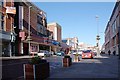
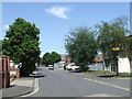
Photos of Derby


Area Information
Derby is a significant built-up area covering 63.4 square kilometres with a population of 116,802. You will find a community defined by its substantial size and urban character. The density of 1,843 people per square kilometre reflects a city environment rather than a quiet rural setting. Daily life here centres around a mix of residential zones and major transport hubs. This location serves as a practical hub for residents seeking established city living. The area hosts a diverse range of domestic establishments and commercial spaces. You can expect a straightforward urban experience without the isolation found in smaller towns. Living in Derby involves navigating a well-established infrastructure designed for a population of over 116,000. The city functions as a cohesive unit where transport links and daily amenities operate with high efficiency. This urban footprint supports a consistent rhythm of life for its inhabitants. The area offers immediate access to the services required by a city-dwelling population. You do not need to travel far for essential daily necessities within the city limits. The density ensures that public services and transport networks remain heavily utilised. Derby remains a solid choice for those preferring established city living over new developments.
- Area Type
- Built Up Area 250
- Area Size
- 63.4 km²
- Population
- 116802
- Population Density
- 1843 people/km²
Residents of Derby have immediate access to practical amenities for daily shopping and travel. The retail landscape includes Lidl Normanton, Tesco Derby, and Aldi Normanton. These three major supermarkets provide essential groceries and household goods. You will find large chains catering to varied consumer preferences within the city. The proximity of these stores minimises travel time for weekly shopping. Five retail outlets operate within the practical reach of the residential zones. This availability ensures you do not need to travel far for basic necessities. Transport infrastructure further supports a mobile lifestyle with five railway stations nearby. These facilities connect the residential area directly to the wider transport network. The amenities listed form the core of the local service provision. You get large-scale retail without entering the main city centre every day. The combination of supermarkets and rail stations creates a functional living environment. Life in Derby revolves around these specific, named conveniences. The amenities are sufficient for most household requirements. They offer a straightforward solution to daily shopping and commuting needs.
Amenities
Schools
Families accessing nursery education in Derby have several specific options to consider. The area hosts Lord Street Nursery School, Central Community Nursery School, Beechwood Nursery School, Harrington Nursery School, and Walbrook Nursery School. These institutions provide care for infants and toddlers. They form the primary link to formal education in the local community. The availability of these five nurseries ensures early childhood provision is present. However, the data does not include primary or secondary schools. This absence of older school ratings limits the picture for those with school-age children. You must verify the location of these nursery schools against your specific address. The presence of nurseries confirms a foundational educational layer for the youngest residents. The mix of schools is currently restricted to early years provision. No other education tiers appear in the immediate vicinity data. This influences the choices for parents with older children who may need to look beyond immediate nursery locations. The named schools offer specific services to the area. They operate under the standard framework of England's nursery sector. The list provides a definitive inventory for early education needs. Understanding this scope helps you plan your family's educational path.
| Rank | School | Type | Entry gender | Ages |
|---|
Explore more schools in this area
Go to Schools tabDemographics
The community profile in Derby reveals a mature population with a median age of 70 years. This statistic indicates that the area caters significantly to older residents. Over two-thirds of households, specifically 62%, own their homes outright or with a mortgage. This high level of home ownership suggests stability within the local estate. The predominant age demographic aligns with retirees rather than young families or professionals. You will find a settled population deeply rooted in their local communities. The household composition and accommodation data point toward a static demographic structure. Future growth or demographic shifts are not reflected in the current data. The lack of young families is a defining characteristic of this neighbourhood. Living in Derby means sharing the space predominantly with seniors. The home ownership figure of 62% is a key metric for potential buyers considering legacy assets. The area does not showcase a blend of mixed generations in the same way younger cities do. Instead, you encounter a specific phase of the life cycle concentrated in one locale. This makes Derby distinct from areas with working-age populations or university students.