Area Overview for Elmton with Creswell
Photos of Elmton with Creswell
Area Information
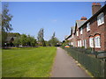
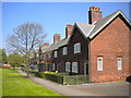
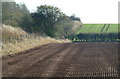
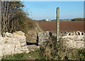
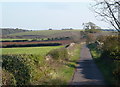
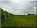
Living in Elmton with Creswell offers a defined sense of place within Derbyshire. This civil parish spans an area of 12.2 km², providing a compact environment where proximity to local services often outweighs extensive travel to larger towns. The character of the parish is shaped by its boundaries and the specific mix of housing found within these limits. For you, potential residents, daily life here revolves around the immediate surroundings rather than distant metropolitan hubs. You will find yourself in a setting where the scale of the locality allows for a focused community experience. The layout of the parish dictates your routine, influencing how quickly you reach a shop, a landmark, or a neighbour. There is no ambiguity about the size of your isolation; the land is strictly measured at just over twelve square kilometres. This concentration means that infrastructure serves a known population without the sprawl typical of larger counties. When you commute or run errands, the distances are short and the context is clear. You are purchasing a location with defined edges, not a vague expansion zone. The parish status confirms an established administrative boundary, which often translates to consistent local management and governance. Your experience of space here is precise and managed.
- Area Type
- Parish
- Area Size
- 12.2 km²
- Population
- Not available
- Population Density
- Not available
Demographics
The community in Elmton with Creswell displays a distinct demographic profile that reflects its residential nature. You will find that the median age across the parish is 70 years. This figure indicates a population skewed significantly towards older residents compared to the national average. Half of all people living in Elmton with Creswell are sixty years of age or older. This age structure suggests a neighbourhood where life pace may be slower and where leisure facilities caters to mature interests are likely central to the local economy. The household composition data points to a total count without specifying single-person or family splits, but the high median age reinforces the idea of households with fewer young dependents. Home ownership stands at 55% of all households. More than half of the residents own their homes outright or with a mortgage, which stabilises the local estate and reduces transient tenancy rates. You are entering a market dominated by those settled in the parish. The accommodation types available follow the general profile of such parishes, though specific breakdowns are not detailed. Ethnically, the predominant group represents the majority, maintaining the traditional demographic makeup of the region. Religious affiliation follows the expected patterns for an older, likely church-attending population. The demographic data paints a picture of stability and age rather than a youthful, rapidly changing scene.
Household Size
Accommodation Type
Tenure
Ethnic Group
Religion
Household Composition
Age
Household Deprivation
NS-SEC
Explore more demographic insights in this area
Go to Demographics tabPlanning
Planning Constraints
- Flood RiskPremium
- Ramsar Wetland SitesPremium
- Area of Outstanding Natural BeautyPremium
- Protected Nature ReservePremium
- Protected WoodlandPremium