Area Overview for Ault Hucknall
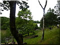
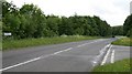
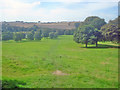
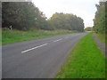
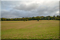
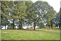
Photos of Ault Hucknall


Area Information
Ault Hucknall is a civil parish situated in England, spanning an area of 17.7 km². Living in Ault Hucknall means inhabiting a defined neighbourhood with specific boundaries and established local services. The parish functions as a distinct community unit within the wider regional landscape. Residents here navigate daily life within this fixed geographical footprint, which influences local travel patterns and community interactions. The area provides a settled environment where the 17.7 km² of land supports the local population. This specific size defines the scale of residential development and the available green space for neighbours. When considering homes in Ault Hucknall, you are looking at a realistic property market anchored by this precise area measurement. The parish structure dictates how local governance operates and how services are delivered to households. This clear definition helps residents understand the administrative context of their home. Living in Ault Hucknall offers a tangible connection to the land and community limits. The area size directly impacts density and the feel of the locality for anyone seeking a specific type of home.
- Area Type
- Parish
- Area Size
- 17.7 km²
- Population
- Not available
- Population Density
- Not available
Demographics
The community in Ault Hucknall is defined by a dominant senior population. The median age sits at exactly 70 years old. This demographic profile indicates that Age: Total does not represent a broad-spectrum mix of life stages. Instead, the neighbourhood reflects the needs and lifestyle of retired residents. You will encounter a population structured around retirement rather than young families or working-age adults moving in for careers. Household composition aligns with this older demographic, showing traditional family and single-person units common in this age bracket. Home ownership levels stand at 70 per cent. This high rate suggests stability and long-term settlement within the parish. Most residents have purchased their property rather than renting them monthly. Accommodation types mirror the age profile, favouring single-storey bungalows or homes adaptable for mobility needs. Diversity within the population follows the national trend where total ethnic groups reflect the primary makeup of the UK. Religion also aligns with general national patterns without distinct local outliers. Data does not highlight unusual concentration of any minority ethnic group or place declaring a different religious affiliation. This straightforward demographic picture helps you understand who your neighbours will be. Living in Ault Hucknall involves joining a community where the average resident is approaching the next stage of retirement.
Household Size
Accommodation Type
Tenure
Ethnic Group
Religion
Household Composition
Age
Household Deprivation
NS-SEC
Explore more demographic insights in this area
Go to Demographics tabPlanning
Planning Constraints
- Flood RiskPremium
- Ramsar Wetland SitesPremium
- Area of Outstanding Natural BeautyPremium
- Protected Nature ReservePremium
- Protected WoodlandPremium
- Crime RiskPremium