Area Overview for Weston Underwood
Photos of Weston Underwood
Area Information
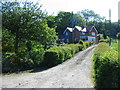
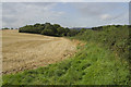
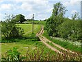
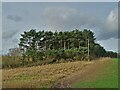
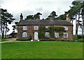
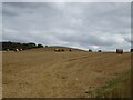
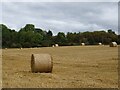
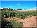
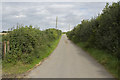
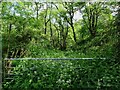
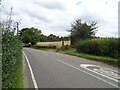
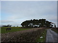
Living in Weston Underwood offers a distinctly rural experience within Berkshire, defined by its quiet character and established community feel. This civil parish covers an area of 12.7 km², providing ample space for open fields and countryside vistas without the density of a larger town centre. The layout supports a lifestyle where daily life revolves around local amenities and the surrounding natural environment rather than urban transit. You will find yourself in a setting that prioritises tranquillity while maintaining a direct connection to the broader Berkshire landscape. The scale of the parish is managed, ensuring that residential areas remain distinct from commercial hubs or industrial zones. Homes here are set back in leafy surroundings, offering privacy and abundant green space as standard features of the property. Your daily routine would likely involve short drives or walks to access shops and services, given the dispersed nature of this suburban village. The environment is stable and predictable, free from major planning constraints that often complicate building projects in other regions. This stability makes Weston Underwood a reliable choice for those seeking a established residential footprint. The area's identity is rooted in its history as a hamlet that has evolved into a well-defined parish. You can expect a consistent lifestyle where the pace of life remains moderate and the neighbourhood retains a strong sense of local identity.
- Area Type
- Parish
- Area Size
- 12.7 km²
- Population
- Not available
- Population Density
- Not available
Demographics
The community profile of Weston Underwood reflects a settled population with a median age of 70 years. This statistic indicates a neighbourhood where long-term residents dominate, suggesting a stable society forged over generations. You are not moving into an area with a transient student or young professional demographic; instead, you join a community of people who have made a permanent home here. The houses in Weston Underwood are overwhelmingly owner-occupied, with a staggering 79% of properties held by their residents. This high ownership rate signifies deep community roots and a lack of short-term rental fluctuations that affect younger estates. While the data does not specify the breakdown of accommodation types beyond ownership status, the demographic picture points clearly towards traditional family homes or retirement dwellings rather than modern apartments. The age profile suggests that local schools near Weston Underwood serve a different student body than those in more youthful towns, or that families rely on alternate education options until they retire. Living here means joining a cohort that values permanence and local continuity. The low level of household turnover implies that neighbours have known each other for decades, fostering informal support networks. There are no indications of rapid demographic shifts or transient populations entering the area. This continuity creates a predictable social environment where community events are likely to be recurring fixtures rather than fleeting happenings. You will be entering a society where connections are deep and established.
Household Size
Accommodation Type
Tenure
Ethnic Group
Religion
Household Composition
Age
Household Deprivation
NS-SEC
Explore more demographic insights in this area
Go to Demographics tabPlanning
Planning Constraints
- Flood RiskPremium
- Ramsar Wetland SitesPremium
- Area of Outstanding Natural BeautyPremium
- Protected Nature ReservePremium
- Protected WoodlandPremium