Area Overview for Holloway (Amber Valley)
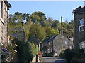
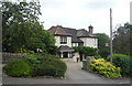
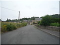
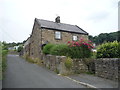
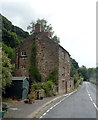
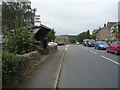
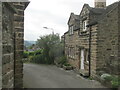
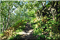
Photos of Holloway (Amber Valley)
Area Information
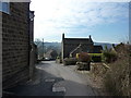
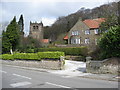
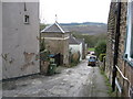
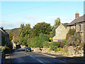
Holloway (Amber Valley) is a compact built-up area spanning 32.1 hectares, nestled in the heart of England. With a median age of 70, it reflects a community that leans towards older residents, though the demographic data suggests a broad age range. The area’s home ownership rate of 78% indicates a stable, long-term presence of residents, many of whom are likely to have lived here for decades. Daily life here is shaped by proximity to essential services and transport links. The presence of five nearby rail stations—Whatstandwell, Cromford, Matlock Bath, and others—offers easy access to regional hubs, while local retail outlets like Budgens Crich and Morrisons Daily cater to everyday needs. For families, the outstanding-rated Lea Primary School provides a strong educational foundation. The area’s small size and well-connected infrastructure create a balance between quiet living and practical accessibility, making it appealing to those seeking a settled, community-oriented environment.
- Area Type
- Built Up Area 250
- Area Size
- 32.1 hectares
- Population
- Not available
- Population Density
- Not available
The lifestyle in Holloway (Amber Valley) is shaped by its proximity to essential amenities. Retail options include Budgens Crich, Morrisons Daily, and Co-op Petrol, providing convenience for daily shopping and fuel needs. Nearby metro areas such as Wirksworth, Darley Dale, and Idridgehay add to the region’s accessibility, offering additional services and leisure opportunities. While the area’s compact size limits large-scale leisure facilities, the rail stations and retail outlets ensure a practical, community-focused lifestyle. The presence of multiple rail links enhances connectivity, allowing residents to explore broader regional attractions easily.
Amenities
Schools
The nearest school to Holloway (Amber Valley) is Lea Primary School, which is rated “outstanding” by Ofsted. As a primary school, it serves children aged 4 to 11, providing a critical educational foundation for local families. The absence of secondary schools in the immediate vicinity means parents may need to consider commuting to nearby towns for secondary education. The single school listed suggests a limited range of educational options, though its high rating offers reassurance for families prioritising quality schooling. For those seeking a primary school with strong performance, Lea Primary School is a key asset of the area.
| Rank | School | Type | Entry gender | Ages |
|---|
Explore more schools in this area
Go to Schools tabDemographics
The population of Holloway (Amber Valley) has a median age of 70, suggesting a community predominantly composed of older adults. The most common age range is listed as “Age: Total,” which may reflect aggregated data rather than a specific cohort. Home ownership is high, with 78% of residents owning their homes, indicating a stable housing market. Accommodation types and household composition are noted as “total,” but no further breakdown is provided. The area’s demographic profile does not include specific details on ethnic diversity or religious composition, though the absence of such data does not imply a lack of diversity. The high home ownership rate and older median age suggest a mature, established population, which may influence local services and amenities.
Household Size
Accommodation Type
Tenure
Ethnic Group
Religion
Household Composition
Age
Household Deprivation
NS-SEC
Explore more demographic insights in this area
Go to Demographics tabPlanning
Planning Constraints
- Crime RiskPremium