Area Overview for Holbrook
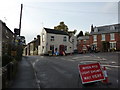
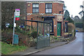
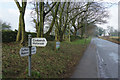
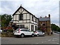
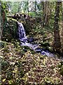
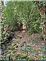
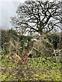
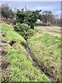
Photos of Holbrook


Area Information
Living in Holbrook offers a distinct experience for those seeking a specific type of country life. This civil parish covers an area of exactly 4.0 square kilometres, creating a compact community where residents know their neighbours. The population profile suggests a settlement defined by its established residents rather than a transient workforce. You can expect a calm environment where daily life moves at a measured pace, away from the congestion of larger towns. The small footprint means that local amenities are likely within easy reach, reducing the need for extensive travel. This area functions as a self-contained neighbourhood where the boundaries between nature and habitation are soft. Property searchers should realise that this is a place for stability, not rapid change. The character of the village is set by its long-term inhabitants who have shaped the local identity over decades. Looking at homes in Holbrook, you are buying into a legacy of continuity rather than a developing boomtown.
- Area Type
- Parish
- Area Size
- 4.0 km²
- Population
- Not available
- Population Density
- Not available
Demographics
The community in Holbrook reflects a settlement deeply rooted in its past. The median age stands at 70 years, indicating a population dominated by older adults rather than families with young children. This age profile shapes the social fabric, with life revolving around retirement and established routines. Home ownership rates reach 81 per cent, creating a society where most residents are settled owners rather than tenants. This high level of possession suggests a community with significant financial stability and a long-term commitment to the locality. When you look at household composition in Holbrook, the data points towards smaller, established households fitting the age demographic. The area lacks the density of recent migration or the volatility often found in younger districts. For buyers interested in schools near Holbrook, the age data suggests demand will focus on special needs provision or continued education rather than primary intake. The demographic reality means you are joining a community where authority and tradition hold significant weight.
Household Size
Accommodation Type
Tenure
Ethnic Group
Religion
Household Composition
Age
Household Deprivation
NS-SEC
Explore more demographic insights in this area
Go to Demographics tabPlanning
Planning Constraints
- Flood RiskPremium
- Ramsar Wetland SitesPremium
- Area of Outstanding Natural BeautyPremium
- Protected Nature ReservePremium
- Protected WoodlandPremium