Area Overview for DE75 7NU
Photos of DE75 7NU


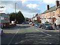
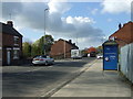
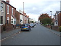
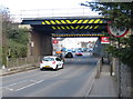
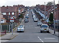
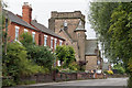
63 photos from this area
Area Information
Key information about the DE75 7NU including its size, population, and administrative classification.
- Area Type
- Postcode
- Area Size
- 2.5 hectares
- Population
- 1684
- Population Density
- 2759 people/km²
House Prices in DE75 7NU
42
Properties
£127,965
Average Sold Price
£51,950
Lowest Price
£270,000
Highest Price
Showing 42 properties
| Address | Type | Beds | Baths | Last Sale Price | Last Sale Date | |
|---|---|---|---|---|---|---|
| 68 Brookfield Way, Heanor, DE75 7NU | Terraced | 3 | 1 | £210,000 | Aug 2025 | |
| 71 Brookfield Way, Heanor, DE75 7NU | Semi-detached | 3 | 2 | £190,000 | Apr 2024 | |
| 67 Brookfield Way, Heanor, DE75 7NU | Semi-detached | 2 | 1 | £185,000 | Jan 2024 | |
| 107 Brookfield Way, Heanor, DE75 7NU | Detached | 3 | 2 | £270,000 | Sep 2023 | |
| 78 Brookfield Way, Heanor, DE75 7NU | house | 2 | 1 | £150,000 | Jul 2022 | |
| 93 Brookfield Way, Heanor, DE75 7NU | Detached | 3 | 2 | £225,000 | Jun 2022 | |
| 111 Brookfield Way, Heanor, DE75 7NU | Semi-detached | 3 | - | £200,000 | May 2022 | |
| 103 Brookfield Way, Heanor, DE75 7NU | Retail | 4 | 2 | £248,000 | Apr 2022 | |
| 86 Brookfield Way, Heanor, DE75 7NU | Terraced | 2 | - | £131,000 | Dec 2020 | |
| 85 Brookfield Way, Heanor, DE75 7NU | house | 3 | - | £215,000 | Sep 2020 |
Page 1 of 5
Energy Efficiency in DE75 7NU
Amenities
Schools
| Rank | School | Type | Entry gender | Ages |
|---|
Explore more schools in this area
Go to Schools tabDemographics
Household Size
Two person
most common
Accommodation Type
Houses
most common
Tenure
71
majority
Ethnic Group
White
most common
Religion
N/A
most common
Household Composition
N/A
most common
Age
47
median
Adults (30-64 years)
most common
Household Deprivation
N/A
with no deprivation
NS-SEC
28
in Lower managerial occupations
Explore more demographic insights in this area
Go to Demographics tabPlanning
Planning Constraints
- Flood RiskPremium
- Ramsar Wetland SitesPremium
- Area of Outstanding Natural BeautyPremium
- Protected Nature ReservePremium
- Protected WoodlandPremium