Area Overview for DE75 7NP
Photos of DE75 7NP

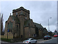
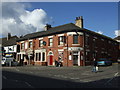


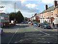
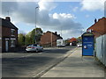
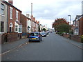
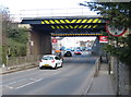
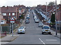
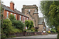
63 photos from this area
Area Information
Key information about the DE75 7NP including its size, population, and administrative classification.
- Area Type
- Postcode
- Area Size
- 3022 m²
- Population
- 1684
- Population Density
- 2759 people/km²
House Prices in DE75 7NP
13
Properties
£109,800
Average Sold Price
£53,500
Lowest Price
£195,050
Highest Price
Showing 13 properties
| Address | Type | Beds | Baths | Last Sale Price | Last Sale Date | |
|---|---|---|---|---|---|---|
| 4 Lavender Gardens, Heanor, DE75 7NP | Terraced | 2 | 1 | £145,000 | Oct 2025 | |
| 7 Lavender Gardens, Heanor, DE75 7NP | Semi-detached | 3 | 1 | £195,050 | Mar 2022 | |
| 5 Lavender Gardens, Heanor, DE75 7NP | Semi-detached | 3 | - | £145,000 | Dec 2017 | |
| 11 Lavender Gardens, Heanor, DE75 7NP | house | 2 | 1 | £105,000 | Nov 2015 | |
| 10 Lavender Gardens, Heanor, DE75 7NP | Terraced | 2 | 1 | £89,000 | Oct 2012 | |
| 3 Lavender Gardens, Heanor, DE75 7NP | Terraced | 2 | 1 | £113,000 | Nov 2007 | |
| 9 Lavender Gardens, Heanor, DE75 7NP | Terraced | 2 | 1 | £104,000 | Aug 2006 | |
| 15 Lavender Gardens, Heanor, DE75 7NP | Terraced | - | - | £125,950 | Aug 2005 | |
| 1 Lavender Gardens, Heanor, DE75 7NP | Terraced | - | - | £130,000 | Oct 2004 | |
| 6 Lavender Gardens, Heanor, DE75 7NP | Semi-detached | 2 | - | £97,000 | Jun 2004 |
Page 1 of 2
Energy Efficiency in DE75 7NP
Amenities
Schools
| Rank | School | Type | Entry gender | Ages |
|---|
Explore more schools in this area
Go to Schools tabDemographics
Household Size
Two person
most common
Accommodation Type
Houses
most common
Tenure
71
majority
Ethnic Group
White
most common
Religion
N/A
most common
Household Composition
N/A
most common
Age
47
median
Adults (30-64 years)
most common
Household Deprivation
N/A
with no deprivation
NS-SEC
28
in Lower managerial occupations
Explore more demographic insights in this area
Go to Demographics tabPlanning
Planning Constraints
- Flood RiskPremium
- Ramsar Wetland SitesPremium
- Area of Outstanding Natural BeautyPremium
- Protected Nature ReservePremium
- Protected WoodlandPremium