Area Overview for DE72 3QF
Photos of DE72 3QF
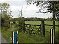
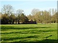
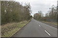

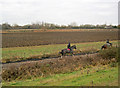
18 photos from this area
Area Information
Key information about the DE72 3QF including its size, population, and administrative classification.
- Area Type
- Postcode
- Area Size
- 1.7 km²
- Population
- 1575
- Population Density
- 387 people/km²
House Prices in DE72 3QF
10
Properties
£374,666
Average Sold Price
£249,332
Lowest Price
£500,000
Highest Price
Showing 10 properties
| Address | Type | Beds | Baths | Last Sale Price | Last Sale Date | |
|---|---|---|---|---|---|---|
| Grange Farm Cottage, Sawley Road, Wilne Cross, Breaston, DE72 3QF | house | 4 | 3 | £500,000 | Apr 2022 | |
| White Gates, Sawley Road, Draycott, DE72 3QF | Detached | - | - | £249,332 | May 2003 | |
| Sawley Grange Farm, Sawley Road, Wilne Cross, Breaston, DE72 3QF | Detached | 6 | 2 | - | - | |
| Brookfield Farm, 201 Sawley Road, Draycott, DE72 3QF | Land | - | - | - | - | |
| Netherlands, Sawley Road, Wilne Cross, Breaston, DE72 3QF | Detached | - | - | - | - | |
| The Elms, Sawley Road, Wilne Cross, Breaston, DE72 3QF | house | - | - | - | - | |
| The Cottage, Fields Farm, Sawley Road, Draycott, DE72 3QF | Detached | - | - | - | - | |
| Caravan And Pitch At, Brookfield Farm, 201 Sawley Road, Draycott, DE72 3QF | Mobile Home | - | - | - | - | |
| Severn Trent Water Ltd, Laboratories, Sawley Road, Wilne Cross, Breaston, DE72 3QF | Office | - | - | - | - | |
| Elms Lodge, Sawley Road, Wilne Cross, Breaston, DE72 3QF | Detached | - | - | - | - |
Energy Efficiency in DE72 3QF
Amenities
Schools
| Rank | School | Type | Entry gender | Ages |
|---|
Explore more schools in this area
Go to Schools tabDemographics
Household Size
Two person
most common
Accommodation Type
Houses
most common
Tenure
85
majority
Ethnic Group
White
most common
Religion
N/A
most common
Household Composition
N/A
most common
Age
47
median
Adults (30-64 years)
most common
Household Deprivation
N/A
with no deprivation
NS-SEC
42
in Lower managerial occupations
Explore more demographic insights in this area
Go to Demographics tabPlanning
Planning Constraints
- Flood RiskPremium
- Ramsar Wetland SitesPremium
- Area of Outstanding Natural BeautyPremium
- Protected Nature ReservePremium
- Protected WoodlandPremium