Area Overview for DE72 3DD
Photos of DE72 3DD

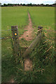
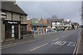
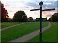
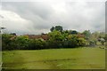
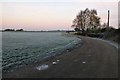
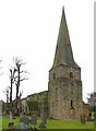
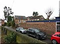
49 photos from this area
Area Information
Key information about the DE72 3DD including its size, population, and administrative classification.
- Area Type
- Postcode
- Area Size
- 7.5 hectares
- Population
- 1575
- Population Density
- 387 people/km²
House Prices in DE72 3DD
42
Properties
£234,331
Average Sold Price
£60,000
Lowest Price
£507,000
Highest Price
Showing 42 properties
| Address | Type | Beds | Baths | Last Sale Price | Last Sale Date | |
|---|---|---|---|---|---|---|
| 34 Marlborough Road, Breaston, DE72 3DD | Semi-detached | 3 | 1 | £346,000 | Aug 2024 | |
| 10 Marlborough Road, Breaston, DE72 3DD | Semi-detached | 3 | 2 | £325,000 | May 2024 | |
| 46 Marlborough Road, Breaston, DE72 3DD | Detached | 3 | 1 | £365,000 | Feb 2024 | |
| 36 Marlborough Road, Breaston, DE72 3DD | Semi-detached | 3 | 2 | £360,000 | Nov 2022 | |
| 20 Marlborough Road, Breaston, DE72 3DD | Retail | 3 | 1 | £287,500 | Apr 2022 | |
| 50 Marlborough Road, Breaston, DE72 3DD | house | - | - | £422,500 | Mar 2021 | |
| 52 Marlborough Road, Breaston, DE72 3DD | Detached | 3 | 1 | £507,000 | Mar 2021 | |
| 44 Marlborough Road, Breaston, DE72 3DD | house | - | - | £333,650 | Apr 2020 | |
| 15 Marlborough Road, Breaston, DE72 3DD | Semi-detached | 3 | 2 | £240,000 | Mar 2019 | |
| 31 Marlborough Road, Breaston, DE72 3DD | Detached | 5 | 2 | £462,000 | Sep 2018 |
Page 1 of 5
Energy Efficiency in DE72 3DD
Amenities
Schools
| Rank | School | Type | Entry gender | Ages |
|---|
Explore more schools in this area
Go to Schools tabDemographics
Household Size
Two person
most common
Accommodation Type
Houses
most common
Tenure
85
majority
Ethnic Group
White
most common
Religion
N/A
most common
Household Composition
N/A
most common
Age
47
median
Adults (30-64 years)
most common
Household Deprivation
N/A
with no deprivation
NS-SEC
42
in Lower managerial occupations
Explore more demographic insights in this area
Go to Demographics tabPlanning
Planning Constraints
- Flood RiskPremium
- Ramsar Wetland SitesPremium
- Area of Outstanding Natural BeautyPremium
- Protected Nature ReservePremium
- Protected WoodlandPremium