Area Overview for DE72 3NX
Photos of DE72 3NX
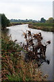
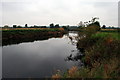
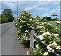
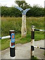
37 photos from this area
Area Information
Key information about the DE72 3NX including its size, population, and administrative classification.
- Area Type
- Postcode
- Area Size
- 11.1 hectares
- Population
- 1499
- Population Density
- 419 people/km²
House Prices in DE72 3NX
52
Properties
£291,880
Average Sold Price
£52,000
Lowest Price
£660,000
Highest Price
Showing 52 properties
| Address | Type | Beds | Baths | Last Sale Price | Last Sale Date | |
|---|---|---|---|---|---|---|
| 123 Derby Road, Draycott, DE72 3NX | Detached | 3 | 1 | £570,000 | Aug 2023 | |
| 93 Derby Road, Draycott, DE72 3NX | Detached | 4 | 2 | £457,000 | May 2023 | |
| 85 Derby Road, Draycott, DE72 3NX | Semi-detached | 3 | 3 | £368,000 | May 2023 | |
| 88 Derby Road, Draycott, DE72 3NX | Semi-detached | 3 | 2 | £358,500 | Sep 2022 | |
| 99 Derby Road, Draycott, DE72 3NX | house | 5 | 1 | £500,000 | Mar 2022 | |
| 105 Derby Road, Draycott, DE72 3NX | house | - | - | £660,000 | Oct 2021 | |
| 121 Derby Road, Draycott, DE72 3NX | Bungalow | - | - | £540,000 | Jun 2021 | |
| 146 Derby Road, Draycott, DE72 3NX | house | - | - | £252,000 | May 2020 | |
| 90-92 Derby Road, Draycott, DE72 3NX | Detached | 5 | 3 | £310,000 | Mar 2020 | |
| 94 Derby Road, Draycott, DE72 3NX | house | - | - | £247,500 | Nov 2019 |
Page 1 of 6
Energy Efficiency in DE72 3NX
Amenities
Schools
| Rank | School | Type | Entry gender | Ages |
|---|
Explore more schools in this area
Go to Schools tabDemographics
Household Size
Two person
most common
Accommodation Type
Houses
most common
Tenure
71
majority
Ethnic Group
White
most common
Religion
N/A
most common
Household Composition
N/A
most common
Age
47
median
Adults (30-64 years)
most common
Household Deprivation
N/A
with no deprivation
NS-SEC
32
in Lower managerial occupations
Explore more demographic insights in this area
Go to Demographics tabPlanning
Planning Constraints
- Flood RiskPremium
- Ramsar Wetland SitesPremium
- Area of Outstanding Natural BeautyPremium
- Protected Nature ReservePremium
- Protected WoodlandPremium