Area Overview for DE56 1GN
Photos of DE56 1GN
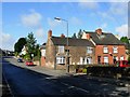
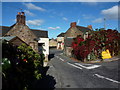


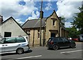


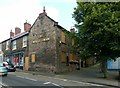

98 photos from this area
Area Information
Key information about the DE56 1GN including its size, population, and administrative classification.
- Area Type
- Postcode
- Area Size
- 2.2 hectares
- Population
- 2002
- Population Density
- 3039 people/km²
House Prices in DE56 1GN
45
Properties
£233,475
Average Sold Price
£49,995
Lowest Price
£620,000
Highest Price
Showing 45 properties
| Address | Type | Beds | Baths | Last Sale Price | Last Sale Date | |
|---|---|---|---|---|---|---|
| 27 Windmill Lane, Belper, DE56 1GN | Semi-detached | 2 | 2 | £325,000 | Sep 2025 | |
| 15 Windmill Lane, Belper, DE56 1GN | house | 4 | 1 | £620,000 | Sep 2022 | |
| 22 Windmill Lane, Belper, DE56 1GN | Semi-detached | 3 | 1 | £238,000 | Sep 2021 | |
| 12 Windmill Lane, Belper, DE56 1GN | Detached | 3 | 1 | £248,000 | Dec 2019 | |
| 38 Windmill Lane, Belper, DE56 1GN | Semi-detached | 3 | 1 | £250,000 | May 2018 | |
| 31A Windmill Lane, Belper, DE56 1GN | Semi-detached | 3 | - | £234,950 | Feb 2017 | |
| 1 Windmill Lane, Belper, DE56 1GN | Detached | 3 | - | £355,000 | Sep 2016 | |
| 40 Windmill Lane, Belper, DE56 1GN | house | - | - | £265,500 | Jun 2016 | |
| 24 Windmill Lane, Belper, DE56 1GN | Semi-detached | 3 | 1 | £165,000 | Feb 2015 | |
| 42 Windmill Lane, Belper, DE56 1GN | house | - | - | £285,000 | Nov 2014 |
Page 1 of 5
Energy Efficiency in DE56 1GN
Amenities
Schools
| Rank | School | Type | Entry gender | Ages |
|---|
Explore more schools in this area
Go to Schools tabDemographics
Household Size
One person
most common
Accommodation Type
Houses
most common
Tenure
63
majority
Ethnic Group
White
most common
Religion
N/A
most common
Household Composition
N/A
most common
Age
47
median
Adults (30-64 years)
most common
Household Deprivation
N/A
with no deprivation
NS-SEC
38
in Lower managerial occupations
Explore more demographic insights in this area
Go to Demographics tabPlanning
Planning Constraints
- Flood RiskPremium
- Ramsar Wetland SitesPremium
- Area of Outstanding Natural BeautyPremium
- Protected Nature ReservePremium
- Protected WoodlandPremium