Area Overview for DE56 1GF
Photos of DE56 1GF
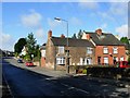
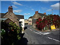


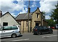


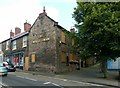

98 photos from this area
Area Information
Key information about the DE56 1GF including its size, population, and administrative classification.
- Area Type
- Postcode
- Area Size
- 1.6 hectares
- Population
- 2002
- Population Density
- 3039 people/km²
House Prices in DE56 1GF
70
Properties
£142,437
Average Sold Price
£32,500
Lowest Price
£347,000
Highest Price
Showing 70 properties
| Address | Type | Beds | Baths | Last Sale Price | Last Sale Date | |
|---|---|---|---|---|---|---|
| 25 High Street, Belper, DE56 1GF | Semi-detached | 3 | 1 | £200,000 | Mar 2025 | |
| 21 High Street, Belper, DE56 1GF | house | - | - | £240,000 | Feb 2025 | |
| 49 High Street, Belper, DE56 1GF | house | 3 | 2 | £347,000 | May 2024 | |
| 18 High Street, Belper, DE56 1GF | Bungalow | 3 | - | £210,000 | Jun 2023 | |
| 58 High Street, Belper, DE56 1GF | Terraced | 2 | 1 | £135,000 | Apr 2023 | |
| 6 High Street, Belper, DE56 1GF | Terraced | 2 | 1 | £177,438 | Mar 2023 | |
| 23 High Street, Belper, DE56 1GF | house | - | - | £240,000 | Feb 2023 | |
| 47 High Street, Belper, DE56 1GF | house | - | - | £250,000 | Jan 2022 | |
| 43 High Street, Belper, DE56 1GF | Cottage | 3 | 2 | £219,000 | May 2021 | |
| 29 High Street, Belper, DE56 1GF | house | 2 | - | £109,000 | Mar 2020 |
Page 1 of 7
Energy Efficiency in DE56 1GF
Amenities
Schools
| Rank | School | Type | Entry gender | Ages |
|---|
Explore more schools in this area
Go to Schools tabDemographics
Household Size
One person
most common
Accommodation Type
Houses
most common
Tenure
63
majority
Ethnic Group
White
most common
Religion
N/A
most common
Household Composition
N/A
most common
Age
47
median
Adults (30-64 years)
most common
Household Deprivation
N/A
with no deprivation
NS-SEC
38
in Lower managerial occupations
Explore more demographic insights in this area
Go to Demographics tabPlanning
Planning Constraints
- Flood RiskPremium
- Ramsar Wetland SitesPremium
- Area of Outstanding Natural BeautyPremium
- Protected Nature ReservePremium
- Protected WoodlandPremium