Area Overview for DE56 1FP
Photos of DE56 1FP
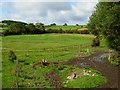
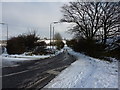
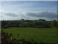
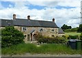
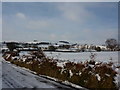
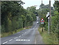

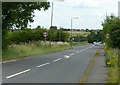
15 photos from this area
Area Information
Key information about the DE56 1FP including its size, population, and administrative classification.
- Area Type
- Postcode
- Area Size
- 29.4 hectares
- Population
- 1388
- Population Density
- 1121 people/km²
House Prices in DE56 1FP
89
Properties
£182,870
Average Sold Price
£46,000
Lowest Price
£535,000
Highest Price
Showing 89 properties
| Address | Type | Beds | Baths | Last Sale Price | Last Sale Date | |
|---|---|---|---|---|---|---|
| 189 Far Laund, Belper, DE56 1FP | Semi-detached | 4 | 1 | £315,000 | Sep 2025 | |
| 206 Far Laund, Belper, DE56 1FP | house | - | - | £261,500 | Mar 2025 | |
| 203 Far Laund, Belper, DE56 1FP | house | 3 | 1 | £210,000 | Oct 2023 | |
| 213 Far Laund, Belper, DE56 1FP | Retail | 4 | 1 | £425,000 | Nov 2022 | |
| 152 Far Laund, Belper, DE56 1FP | house | 3 | 1 | £286,000 | Oct 2022 | |
| 140 Far Laund, Belper, DE56 1FP | Semi-detached | 3 | 1 | £325,000 | Jul 2022 | |
| 146 Far Laund, Belper, DE56 1FP | Semi-detached | 3 | 1 | £290,000 | May 2022 | |
| 154 Far Laund, Belper, DE56 1FP | house | - | - | £240,000 | Apr 2022 | |
| 148 Far Laund, Belper, DE56 1FP | Semi-detached | 3 | - | £232,000 | Jan 2022 | |
| 161 Far Laund, Belper, DE56 1FP | house | - | - | £146,750 | Oct 2021 |
Page 1 of 9
Energy Efficiency in DE56 1FP
Amenities
Schools
| Rank | School | Type | Entry gender | Ages |
|---|
Explore more schools in this area
Go to Schools tabDemographics
Household Size
Two person
most common
Accommodation Type
Houses
most common
Tenure
86
majority
Ethnic Group
White
most common
Religion
N/A
most common
Household Composition
N/A
most common
Age
47
median
Adults (30-64 years)
most common
Household Deprivation
N/A
with no deprivation
NS-SEC
35
in Lower managerial occupations
Explore more demographic insights in this area
Go to Demographics tabPlanning
Planning Constraints
- Flood RiskPremium
- Ramsar Wetland SitesPremium
- Area of Outstanding Natural BeautyPremium
- Protected Nature ReservePremium
- Protected WoodlandPremium