Area Overview for DE56 0SU
Photos of DE56 0SU
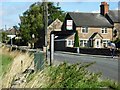
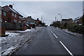

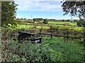
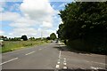
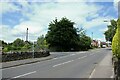
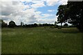
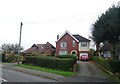
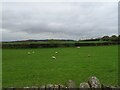
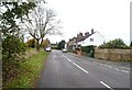
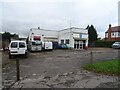
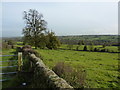
26 photos from this area
Area Information
Key information about the DE56 0SU including its size, population, and administrative classification.
- Area Type
- Postcode
- Area Size
- 18.5 hectares
- Population
- 1768
- Population Density
- 961 people/km²
House Prices in DE56 0SU
73
Properties
£206,316
Average Sold Price
£25,000
Lowest Price
£410,000
Highest Price
Showing 73 properties
| Address | Type | Beds | Baths | Last Sale Price | Last Sale Date | |
|---|---|---|---|---|---|---|
| 2, Border Cottages, Belper Road, Bargate, Belper, DE56 0SU | Cottage | 2 | 1 | £217,500 | May 2025 | |
| 125 Belper Road, Bargate, Belper, DE56 0SU | Terraced | 3 | 2 | £290,000 | Apr 2025 | |
| 106 Belper Road, Bargate, Belper, DE56 0SU | Semi-detached | 2 | 1 | £192,500 | Feb 2025 | |
| 139 Belper Road, Bargate, Belper, DE56 0SU | Terraced | 2 | 1 | £307,500 | Dec 2024 | |
| 97 Belper Road, Bargate, Belper, DE56 0SU | Detached | 2 | 1 | £137,000 | Dec 2024 | |
| 105 Belper Road, Bargate, Belper, DE56 0SU | Semi-detached | 3 | 2 | £322,500 | Oct 2024 | |
| 123 Belper Road, Bargate, Belper, DE56 0SU | Terraced | 3 | 2 | £250,000 | Dec 2023 | |
| 83 Belper Road, Bargate, Belper, DE56 0SU | Semi-detached | 3 | 1 | £340,000 | Dec 2022 | |
| 82 Belper Road, Bargate, Belper, DE56 0SU | Bungalow | - | - | £320,000 | Dec 2022 | |
| Griffins, 145 Belper Road, Bargate, Belper, DE56 0SU | Detached | 3 | 1 | £285,000 | Jun 2021 |
Page 1 of 8
Energy Efficiency in DE56 0SU
Amenities
Schools
| Rank | School | Type | Entry gender | Ages |
|---|
Explore more schools in this area
Go to Schools tabDemographics
Household Size
Family (3-5 people)
most common
Accommodation Type
Houses
most common
Tenure
77
majority
Ethnic Group
White
most common
Religion
N/A
most common
Household Composition
N/A
most common
Age
47
median
Adults (30-64 years)
most common
Household Deprivation
N/A
with no deprivation
NS-SEC
35
in Lower managerial occupations
Explore more demographic insights in this area
Go to Demographics tabPlanning
Planning Constraints
- Flood RiskPremium
- Ramsar Wetland SitesPremium
- Area of Outstanding Natural BeautyPremium
- Protected Nature ReservePremium
- Protected WoodlandPremium