Area Overview for DE55 5JR
Photos of DE55 5JR
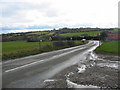

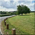
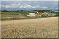
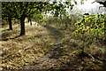
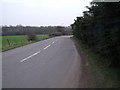
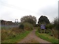
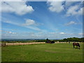
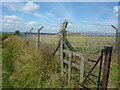
18 photos from this area
Area Information
Key information about the DE55 5JR including its size, population, and administrative classification.
- Area Type
- Postcode
- Area Size
- 41.6 hectares
- Population
- 1204
- Population Density
- 1050 people/km²
House Prices in DE55 5JR
47
Properties
£119,090
Average Sold Price
£15,480
Lowest Price
£280,000
Highest Price
Showing 47 properties
| Address | Type | Beds | Baths | Last Sale Price | Last Sale Date | |
|---|---|---|---|---|---|---|
| 123 The Ridge, Blackwell, DE55 5JR | house | 3 | 1 | £205,000 | Dec 2022 | |
| 3, Hillcrest, The Ridge, Blackwell, DE55 5JR | house | 4 | 1 | £210,000 | Jul 2022 | |
| 4, Hillcrest, The Ridge, Blackwell, DE55 5JR | Semi-detached | 4 | 2 | £280,000 | Dec 2021 | |
| 100 The Ridge, Blackwell, DE55 5JR | house | - | - | £162,000 | Sep 2021 | |
| 58 The Ridge, Blackwell, DE55 5JR | house | - | - | £105,000 | Mar 2021 | |
| 94 The Ridge, Blackwell, DE55 5JR | Semi-detached | 2 | 1 | £100,000 | Oct 2020 | |
| 92 The Ridge, Blackwell, DE55 5JR | house | - | - | £95,000 | Sep 2016 | |
| 101 The Ridge, Blackwell, DE55 5JR | Semi-detached | 3 | 1 | £90,000 | Jul 2016 | |
| 124 The Ridge, Blackwell, DE55 5JR | Semi-detached | 3 | - | £89,950 | May 2016 | |
| 1, Hillcrest, The Ridge, Blackwell, DE55 5JR | Semi-detached | 4 | 1 | £210,000 | Dec 2015 |
Page 1 of 5
Energy Efficiency in DE55 5JR
Amenities
Schools
| Rank | School | Type | Entry gender | Ages |
|---|
Explore more schools in this area
Go to Schools tabDemographics
Household Size
Family (3-5 people)
most common
Accommodation Type
Houses
most common
Tenure
64
majority
Ethnic Group
White
most common
Religion
N/A
most common
Household Composition
N/A
most common
Age
47
median
Adults (30-64 years)
most common
Household Deprivation
N/A
with no deprivation
NS-SEC
22
in Lower managerial occupations
Explore more demographic insights in this area
Go to Demographics tabPlanning
Planning Constraints
- Flood RiskPremium
- Ramsar Wetland SitesPremium
- Area of Outstanding Natural BeautyPremium
- Protected Nature ReservePremium
- Protected WoodlandPremium