Area Overview for DE55 5AL
Photos of DE55 5AL
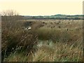
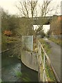
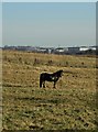
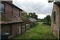
39 photos from this area
Area Information
Key information about the DE55 5AL including its size, population, and administrative classification.
- Area Type
- Postcode
- Area Size
- 24.3 hectares
- Population
- 1706
- Population Density
- 104 people/km²
House Prices in DE55 5AL
18
Properties
£153,500
Average Sold Price
£26,000
Lowest Price
£540,000
Highest Price
Showing 18 properties
| Address | Type | Beds | Baths | Last Sale Price | Last Sale Date | |
|---|---|---|---|---|---|---|
| 21 Park Mill Drive, Westhouses, DE55 5AL | Semi-detached | 3 | 1 | £171,000 | Nov 2022 | |
| Park Mill Farm, Park Mill Drive, Westhouses, DE55 5AL | Retail | 1 | 1 | £540,000 | Jul 2022 | |
| 19 Park Mill Drive, Westhouses, DE55 5AL | house | - | - | £82,500 | Jan 2021 | |
| 11 Park Mill Drive, Westhouses, DE55 5AL | house | - | - | £105,000 | Oct 2018 | |
| 4 Silver Birch Crescent, Westhouses, DE55 5AL | Bungalow | - | - | £369,000 | Jan 2017 | |
| 1 Park Mill Drive, Westhouses, DE55 5AL | house | - | - | £83,000 | Aug 2015 | |
| 7 Park Mill Drive, Westhouses, DE55 5AL | Semi-detached | - | - | £115,000 | Apr 2011 | |
| 23 Park Mill Drive, Westhouses, DE55 5AL | Semi-detached | 2 | 2 | £52,000 | Aug 2003 | |
| 5 Park Mill Drive, Westhouses, DE55 5AL | house | - | - | £29,995 | Apr 2002 | |
| 3 Park Mill Drive, Westhouses, DE55 5AL | Terraced | - | - | £26,000 | Feb 2002 |
Page 1 of 2
Energy Efficiency in DE55 5AL
Amenities
Schools
| Rank | School | Type | Entry gender | Ages |
|---|
Explore more schools in this area
Go to Schools tabDemographics
Household Size
Two person
most common
Accommodation Type
Houses
most common
Tenure
73
majority
Ethnic Group
White
most common
Religion
N/A
most common
Household Composition
N/A
most common
Age
47
median
Adults (30-64 years)
most common
Household Deprivation
N/A
with no deprivation
NS-SEC
36
in Lower managerial occupations
Explore more demographic insights in this area
Go to Demographics tabPlanning
Planning Constraints
- Flood RiskPremium
- Ramsar Wetland SitesPremium
- Area of Outstanding Natural BeautyPremium
- Protected Nature ReservePremium
- Protected WoodlandPremium