Area Overview for DE55 4PS
Photos of DE55 4PS

Area Information
Living in DE55 4PS means being part of a tightly knit residential cluster in England, where 1,398 people reside across 1.3 hectares. The area’s compact size fosters a close-knit community, with a median age of 47 and a majority of residents aged 30–64. This suggests a stable, established population, likely with strong local ties. The postcode’s small footprint means amenities and services are within practical reach, though the density—886 people per square kilometre—implies a mix of housing types and shared spaces. Daily life here is shaped by proximity to schools, retail, and rail links, making it suitable for families and commuters. While the area lacks natural constraints like protected woodlands or AONBs, its accessibility to nearby towns and transport hubs adds practical appeal. For those seeking a balance between rural tranquillity and urban connectivity, DE55 4PS offers a compact, functional living environment with clear advantages for those prioritising convenience over expansive landscapes.
- Area Type
- Postcode
- Area Size
- 1.3 hectares
- Population
- 1398
- Population Density
- 886 people/km²
The property market in DE55 4PS is characterised by a 46% home ownership rate, indicating a mix of owner-occupied properties and rental units. The accommodation type is predominantly houses, which is unusual for smaller postcode areas, suggesting a focus on single-family homes rather than apartments or terraced housing. This composition may appeal to buyers seeking private, spacious living environments, though the limited area size means housing stock is constrained. The small footprint of DE55 4PS implies that property availability is limited, potentially driving competition among buyers. For those considering the area, the emphasis on houses aligns with a demographic prioritising family-friendly spaces. However, the lack of data on property prices or recent developments means buyers should investigate local real estate listings for up-to-date insights.
House Prices in DE55 4PS
Showing 1 properties
| Address | Type | Beds | Baths | Last Sale Price | Last Sale Date | |
|---|---|---|---|---|---|---|
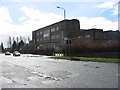
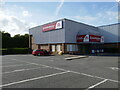
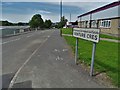
| T C Harrison Jcb, Avbc Unit 56, Wimsey Way, Somercotes, Alfreton, DE55 4PS | shop | - | - | - | - |
Energy Efficiency in DE55 4PS
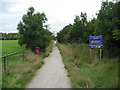
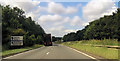
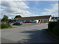
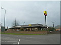
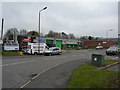
The lifestyle in DE55 4PS is shaped by its proximity to essential amenities, including retail and transport hubs. Local shops such as Aldi Somercotes, Iceland Alfreton, and Co-op Somercotes provide everyday convenience, while nearby rail stations like Alfreton, Ambergate, and Langley Mill offer easy access to commuting routes. Although the area lacks large parks or leisure facilities, its compact size ensures that residents can reach these services without long journeys. The mix of retail options and transport links supports a practical, community-focused lifestyle, where daily errands and travel are efficiently managed. For families, the presence of schools and nearby shops creates a self-contained environment, reducing the need for long commutes. The area’s small footprint means its character is defined by local shops, schools, and rail connections, offering a blend of convenience and accessibility.
Amenities
Schools
Residents of DE55 4PS have access to a range of educational institutions, including Somerlea Park Junior School, which operates as an academy with a ‘good’ Ofsted rating, and Somercotes Infant School, a primary school with a similar rating. The area also includes Somercotes Infant and Nursery School, an academy with a ‘good’ rating, and a second instance of Somerlea Park Junior School listed as an academy. This mix of primary schools and academies provides families with options for early education, though the duplication of school names may reflect administrative nuances. The consistent ‘good’ Ofsted ratings suggest a reliable standard of education, which is a key consideration for families prioritising school quality. The proximity of these institutions to residential properties enhances the area’s appeal for households with children.
| Rank | School | Type | Entry gender | Ages |
|---|
Explore more schools in this area
Go to Schools tabDemographics
The community in DE55 4PS is predominantly middle-aged, with a median age of 47 and 46% of residents owning their homes. This indicates a stable population, with a strong presence of adults aged 30–64, suggesting a mix of working professionals and families. The area is largely composed of houses, reflecting a traditional housing stock that contrasts with higher-density developments. The predominant ethnic group is White, which aligns with broader regional demographics. While no specific data on deprivation is provided, the high home ownership rate and moderate age range imply a relatively secure economic profile. However, the absence of detailed diversity metrics means the community’s full composition remains less defined. For buyers, this suggests a neighbourhood where long-term residency is common, with a focus on family-oriented living and established local networks.
Household Size
Accommodation Type
Tenure
Ethnic Group
Religion
Household Composition
Age
Household Deprivation
NS-SEC
Explore more demographic insights in this area
Go to Demographics tabPlanning
Planning Constraints
- Flood RiskPremium
- Ramsar Wetland SitesPremium
- Area of Outstanding Natural BeautyPremium
- Protected Nature ReservePremium
- Protected WoodlandPremium