Area Overview for DE55 2BG
Photos of DE55 2BG
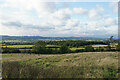
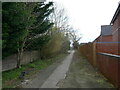
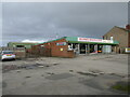
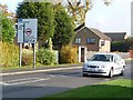
27 photos from this area
Area Information
Key information about the DE55 2BG including its size, population, and administrative classification.
- Area Type
- Postcode
- Area Size
- 1.8 hectares
- Population
- 1600
- Population Density
- 468 people/km²
House Prices in DE55 2BG
25
Properties
£137,575
Average Sold Price
£54,000
Lowest Price
£330,000
Highest Price
Showing 25 properties
| Address | Type | Beds | Baths | Last Sale Price | Last Sale Date | |
|---|---|---|---|---|---|---|
| 16 Monsal Drive, South Normanton, DE55 2BG | Semi-detached | 5 | 1 | £330,000 | May 2023 | |
| 17 Monsal Drive, South Normanton, DE55 2BG | house | - | - | £204,000 | Jun 2020 | |
| 1 Monsal Drive, South Normanton, DE55 2BG | Bungalow | 2 | - | £125,000 | Feb 2017 | |
| 10 Monsal Drive, South Normanton, DE55 2BG | Bungalow | 2 | - | £140,000 | Jun 2015 | |
| 3 Monsal Drive, South Normanton, DE55 2BG | Bungalow | 2 | - | £122,000 | Nov 2013 | |
| 31 Monsal Drive, South Normanton, DE55 2BG | Bungalow | - | - | £122,000 | Oct 2011 | |
| 2 Monsal Drive, South Normanton, DE55 2BG | Bungalow | - | - | £155,000 | May 2007 | |
| 25 Monsal Drive, South Normanton, DE55 2BG | Detached | - | - | £59,000 | Sep 2001 | |
| 12 Monsal Drive, South Normanton, DE55 2BG | Detached | - | - | £54,000 | Dec 1997 | |
| 7 Monsal Drive, South Normanton, DE55 2BG | Bungalow | - | - | £64,750 | Aug 1995 |
Page 1 of 3
Energy Efficiency in DE55 2BG
Amenities
Schools
| Rank | School | Type | Entry gender | Ages |
|---|
Explore more schools in this area
Go to Schools tabDemographics
Household Size
One person
most common
Accommodation Type
Houses
most common
Tenure
60
majority
Ethnic Group
White
most common
Religion
N/A
most common
Household Composition
N/A
most common
Age
47
median
Adults (30-64 years)
most common
Household Deprivation
N/A
with no deprivation
NS-SEC
21
in Lower managerial occupations
Explore more demographic insights in this area
Go to Demographics tabPlanning
Planning Constraints
- Flood RiskPremium
- Ramsar Wetland SitesPremium
- Area of Outstanding Natural BeautyPremium
- Protected Nature ReservePremium
- Protected WoodlandPremium