Area Overview for DE45 1UZ
Photos of DE45 1UZ
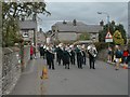


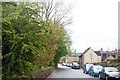
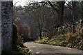
![Youlgrave houses [1] in DE45 1UZ](https://images.propbar.co.uk/images/geograph/58/62/5862374_120.jpg)
60 photos from this area
Area Information
Key information about the DE45 1UZ including its size, population, and administrative classification.
- Area Type
- Postcode
- Area Size
- 664 m²
- Population
- 1519
- Population Density
- 39 people/km²
House Prices in DE45 1UZ
6
Properties
£265,750
Average Sold Price
£201,500
Lowest Price
£330,000
Highest Price
Showing 6 properties
| Address | Type | Beds | Baths | Last Sale Price | Last Sale Date | |
|---|---|---|---|---|---|---|
| Bank House, 3 Bankside, Youlgrave, DE45 1UZ | house | - | - | £330,000 | May 2022 | |
| WILLOW COTTAGE, 2 BANKSIDE, Youlgrave, DE45 1UZ | Detached | 1 | 1 | £201,500 | Apr 2022 | |
| Old Candle Shop, 4 Bankside, Youlgrave, DE45 1UZ | Terraced | - | - | - | - | |
| Thyme Cottage, 1 Bankside, Youlgrave, DE45 1UZ | Cottage | 1 | 1 | - | - | |
| Sunnydale Cottage, Bankside, Youlgrave, DE45 1UZ | house | - | - | - | - | |
| Sunnydale, Bankside, Youlgrave, DE45 1UZ | house | - | - | - | - |
Energy Efficiency in DE45 1UZ
Amenities
Schools
| Rank | School | Type | Entry gender | Ages |
|---|
Explore more schools in this area
Go to Schools tabDemographics
Household Size
Two person
most common
Accommodation Type
Houses
most common
Tenure
69
majority
Ethnic Group
White
most common
Religion
N/A
most common
Household Composition
N/A
most common
Age
47
median
Adults (30-64 years)
most common
Household Deprivation
N/A
with no deprivation
NS-SEC
36
in Lower managerial occupations
Explore more demographic insights in this area
Go to Demographics tabPlanning
Planning Constraints
- Flood RiskPremium
- Ramsar Wetland SitesPremium
- Area of Outstanding Natural BeautyPremium
- Protected Nature ReservePremium
- Protected WoodlandPremium