Area Overview for DE45 1UX
Photos of DE45 1UX
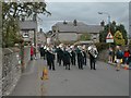


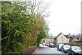
![Youlgrave houses [1] in DE45 1UX](https://images.propbar.co.uk/images/geograph/58/62/5862374_120.jpg)
60 photos from this area
Area Information
Key information about the DE45 1UX including its size, population, and administrative classification.
- Area Type
- Postcode
- Area Size
- 2716 m²
- Population
- 1519
- Population Density
- 39 people/km²
House Prices in DE45 1UX
5
Properties
£234,167
Average Sold Price
£210,000
Lowest Price
£280,000
Highest Price
Showing 5 properties
| Address | Type | Beds | Baths | Last Sale Price | Last Sale Date | |
|---|---|---|---|---|---|---|
| Crimbles Cottage, Crimbles Lane, Youlgrave, DE45 1UX | Detached | 3 | - | £280,000 | Dec 2015 | |
| The Cottage, Crimbles Lane, Youlgrave, DE45 1UX | Semi-detached | 1 | - | £210,000 | Jul 2014 | |
| Brooklyn, Crimbles Lane, Youlgrave, DE45 1UX | house | - | - | £212,500 | Dec 2010 | |
| Rock Cottage, Crimbles Lane, Youlgrave, DE45 1UX | Detached | - | - | - | - | |
| Rose Cottage, Main Street, Youlgrave, DE45 1UX | Detached | - | - | - | - |
Energy Efficiency in DE45 1UX
Amenities
Schools
| Rank | School | Type | Entry gender | Ages |
|---|
Explore more schools in this area
Go to Schools tabDemographics
Household Size
Two person
most common
Accommodation Type
Houses
most common
Tenure
69
majority
Ethnic Group
White
most common
Religion
N/A
most common
Household Composition
N/A
most common
Age
47
median
Adults (30-64 years)
most common
Household Deprivation
N/A
with no deprivation
NS-SEC
36
in Lower managerial occupations
Explore more demographic insights in this area
Go to Demographics tabPlanning
Planning Constraints
- Flood RiskPremium
- Ramsar Wetland SitesPremium
- Area of Outstanding Natural BeautyPremium
- Protected Nature ReservePremium
- Protected WoodlandPremium