Area Overview for DE4 5NH
Photos of DE4 5NH
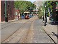

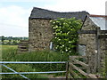

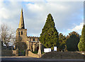
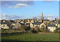
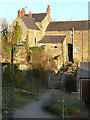

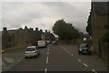
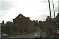
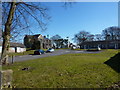
100 photos from this area
Area Information
Key information about the DE4 5NH including its size, population, and administrative classification.
- Area Type
- Postcode
- Area Size
- 1.5 hectares
- Population
- 1111
- Population Density
- 412 people/km²
House Prices in DE4 5NH
27
Properties
£220,474
Average Sold Price
£94,950
Lowest Price
£468,000
Highest Price
Showing 27 properties
| Address | Type | Beds | Baths | Last Sale Price | Last Sale Date | |
|---|---|---|---|---|---|---|
| 21A Hodder Close, Crich, Matlock, DE4 5NH | Terraced | 3 | 2 | £239,950 | Oct 2024 | |
| 15 Hodder Close, Crich, Matlock, DE4 5NH | Semi-detached | 3 | 3 | £288,000 | Aug 2023 | |
| 29 Hodder Close, Crich, Matlock, DE4 5NH | Detached | 5 | 3 | £468,000 | Nov 2021 | |
| 20 Hodder Close, Crich, Matlock, DE4 5NH | house | 3 | - | £285,000 | May 2021 | |
| 22 Hodder Close, Crich, Matlock, DE4 5NH | Detached | 3 | 2 | £310,000 | Sep 2020 | |
| 25 Hodder Close, Crich, Matlock, DE4 5NH | Detached | 4 | 1 | £362,000 | Jun 2019 | |
| 23 Hodder Close, Crich, Matlock, DE4 5NH | Terraced | 3 | 2 | £162,000 | Oct 2015 | |
| 19 Hodder Close, Crich, Matlock, DE4 5NH | Semi-detached | 3 | 3 | £186,000 | Jul 2015 | |
| 9 Hodder Close, Crich, Matlock, DE4 5NH | house | 3 | 2 | £185,000 | Aug 2013 | |
| The Willows, 27 Hodder Close, Crich, Matlock, DE4 5NH | house | - | - | £310,000 | Jan 2010 |
Page 1 of 3
Energy Efficiency in DE4 5NH
Amenities
Schools
| Rank | School | Type | Entry gender | Ages |
|---|
Explore more schools in this area
Go to Schools tabDemographics
Household Size
Two person
most common
Accommodation Type
Houses
most common
Tenure
68
majority
Ethnic Group
White
most common
Religion
N/A
most common
Household Composition
N/A
most common
Age
47
median
Adults (30-64 years)
most common
Household Deprivation
N/A
with no deprivation
NS-SEC
36
in Lower managerial occupations
Explore more demographic insights in this area
Go to Demographics tabPlanning
Planning Constraints
- Flood RiskPremium
- Ramsar Wetland SitesPremium
- Area of Outstanding Natural BeautyPremium
- Protected Nature ReservePremium
- Protected WoodlandPremium