Area Overview for DE4 5DS
Photos of DE4 5DS


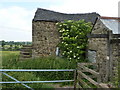

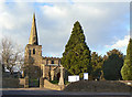
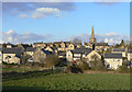
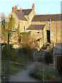

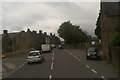

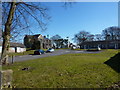

100 photos from this area
Area Information
Key information about the DE4 5DS including its size, population, and administrative classification.
- Area Type
- Postcode
- Area Size
- 6.7 hectares
- Population
- 1111
- Population Density
- 412 people/km²
House Prices in DE4 5DS
45
Properties
£233,228
Average Sold Price
£95,000
Lowest Price
£446,250
Highest Price
Showing 45 properties
| Address | Type | Beds | Baths | Last Sale Price | Last Sale Date | |
|---|---|---|---|---|---|---|
| 15 Coasthill, Crich, Matlock, DE4 5DS | Semi-detached | 3 | 1 | £261,000 | Jun 2023 | |
| 2, Coast Hill Terrace, Coasthill, Crich, Matlock, DE4 5DS | Terraced | 3 | 1 | £234,999 | May 2023 | |
| Holcroft, 27 Coasthill, Crich, Matlock, DE4 5DS | Bungalow | - | - | £350,000 | Mar 2022 | |
| Arlen, 35 Coasthill, Crich, Matlock, DE4 5DS | house | 3 | - | £446,250 | Nov 2021 | |
| 3 Coasthill, Crich, Matlock, DE4 5DS | Terraced | 4 | - | £170,000 | Jul 2020 | |
| Brookfield, 30 Coasthill, Crich, Matlock, DE4 5DS | Semi-detached | 3 | 1 | £247,000 | Oct 2018 | |
| Glenthorne, 34 Coasthill, Crich, Matlock, DE4 5DS | Bungalow | 3 | 1 | £205,000 | Dec 2017 | |
| Oakhurst, 29 Coasthill, Crich, Matlock, DE4 5DS | Detached | 3 | - | £255,000 | Oct 2017 | |
| 33 Coasthill, Crich, Matlock, DE4 5DS | Detached | 3 | 2 | £300,000 | Sep 2016 | |
| 31 Coasthill, Crich, Matlock, DE4 5DS | house | 3 | - | £305,000 | Nov 2014 |
Page 1 of 5
Energy Efficiency in DE4 5DS
Amenities
Schools
| Rank | School | Type | Entry gender | Ages |
|---|
Explore more schools in this area
Go to Schools tabDemographics
Household Size
Two person
most common
Accommodation Type
Houses
most common
Tenure
68
majority
Ethnic Group
White
most common
Religion
N/A
most common
Household Composition
N/A
most common
Age
47
median
Adults (30-64 years)
most common
Household Deprivation
N/A
with no deprivation
NS-SEC
36
in Lower managerial occupations
Explore more demographic insights in this area
Go to Demographics tabPlanning
Planning Constraints
- Flood RiskPremium
- Ramsar Wetland SitesPremium
- Area of Outstanding Natural BeautyPremium
- Protected Nature ReservePremium
- Protected WoodlandPremium