Area Overview for DE4 5DD
Photos of DE4 5DD


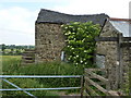

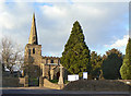
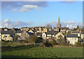
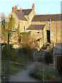

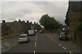
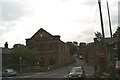
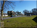

100 photos from this area
Area Information
Key information about the DE4 5DD including its size, population, and administrative classification.
- Area Type
- Postcode
- Area Size
- 1.7 hectares
- Population
- 1542
- Population Density
- 168 people/km²
House Prices in DE4 5DD
47
Properties
£284,556
Average Sold Price
£142,000
Lowest Price
£527,500
Highest Price
Showing 47 properties
| Address | Type | Beds | Baths | Last Sale Price | Last Sale Date | |
|---|---|---|---|---|---|---|
| Marlum, Market Place, Crich, Matlock, DE4 5DD | Semi-detached | 2 | 1 | £155,000 | Dec 2024 | |
| Epworth, Market Place, Crich, Matlock, DE4 5DD | Terraced | 2 | 1 | £200,000 | Nov 2022 | |
| IVY DENE, MARKET PLACE, Crich, Matlock, DE4 5DD | Detached | 3 | 1 | £376,500 | Mar 2021 | |
| Market House, Market Place, Crich, Matlock, DE4 5DD | Land | 2 | - | £527,500 | Feb 2021 | |
| Balbriggan, Market Place, Crich, Matlock, DE4 5DD | Semi-detached | 3 | 1 | £230,000 | Nov 2020 | |
| The Manse, Market Place, Crich, Matlock, DE4 5DD | Terraced | - | - | £275,000 | May 2020 | |
| Masson House, Market Place, Crich, Matlock, DE4 5DD | Detached | - | - | £410,000 | Jul 2004 | |
| Holmleigh, Market Place, Crich, Matlock, DE4 5DD | Semi-detached | - | - | £245,000 | Sep 2003 | |
| The Hollies, Market Place, Crich, Matlock, DE4 5DD | Detached | - | - | £142,000 | Mar 1996 | |
| 1, Mansion Cottages, Market Place, Crich, Matlock, DE4 5DD | house | 2 | 1 | - | - |
Page 1 of 5
Energy Efficiency in DE4 5DD
Amenities
Schools
| Rank | School | Type | Entry gender | Ages |
|---|
Explore more schools in this area
Go to Schools tabDemographics
Household Size
Two person
most common
Accommodation Type
Houses
most common
Tenure
80
majority
Ethnic Group
White
most common
Religion
N/A
most common
Household Composition
N/A
most common
Age
47
median
Adults (30-64 years)
most common
Household Deprivation
N/A
with no deprivation
NS-SEC
45
in Lower managerial occupations
Explore more demographic insights in this area
Go to Demographics tabPlanning
Planning Constraints
- Flood RiskPremium
- Ramsar Wetland SitesPremium
- Area of Outstanding Natural BeautyPremium
- Protected Nature ReservePremium
- Protected WoodlandPremium