Area Overview for DE4 3RT
Photos of DE4 3RT
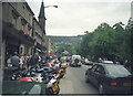
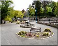
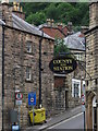
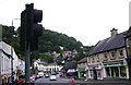
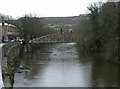
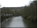
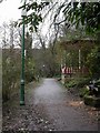
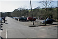


100 photos from this area
Area Information
Key information about the DE4 3RT including its size, population, and administrative classification.
- Area Type
- Postcode
- Area Size
- 4835 m²
- Population
- 1447
- Population Density
- 127 people/km²
House Prices in DE4 3RT
18
Properties
£155,938
Average Sold Price
£107,000
Lowest Price
£238,000
Highest Price
Showing 18 properties
| Address | Type | Beds | Baths | Last Sale Price | Last Sale Date | |
|---|---|---|---|---|---|---|
| 236 Dale Road, Matlock Bath, DE4 3RT | Flat | - | - | £177,001 | Sep 2021 | |
| 238 Dale Road, Matlock Bath, DE4 3RT | Flat | - | - | £147,500 | Jun 2015 | |
| 226 Dale Road, Matlock Bath, DE4 3RT | house | 7 | - | £195,000 | Oct 2014 | |
| 218 Dale Road, Matlock Bath, DE4 3RT | house | 5 | - | £115,000 | Feb 2011 | |
| 232 Dale Road, Matlock Bath, DE4 3RT | Flat | - | - | £115,000 | Feb 2010 | |
| 216 Dale Road, Matlock Bath, DE4 3RT | house | - | - | £153,000 | Feb 2010 | |
| 228 Dale Road, Matlock Bath, DE4 3RT | Terraced | 5 | 2 | £238,000 | Jul 2009 | |
| 220 Dale Road, Matlock Bath, DE4 3RT | house | 4 | - | £107,000 | Sep 2001 | |
| 224 Dale Road, Matlock Bath, DE4 3RT | Semi-detached | 4 | 1 | - | - | |
| 222 Dale Road, Matlock Bath, DE4 3RT | Terraced | 8 | 2 | - | - |
Page 1 of 2
Energy Efficiency in DE4 3RT
Amenities
Schools
| Rank | School | Type | Entry gender | Ages |
|---|
Explore more schools in this area
Go to Schools tabDemographics
Household Size
Two person
most common
Accommodation Type
Houses
most common
Tenure
80
majority
Ethnic Group
White
most common
Religion
N/A
most common
Household Composition
N/A
most common
Age
47
median
Adults (30-64 years)
most common
Household Deprivation
N/A
with no deprivation
NS-SEC
43
in Lower managerial occupations
Explore more demographic insights in this area
Go to Demographics tabPlanning
Planning Constraints
- Flood RiskPremium
- Ramsar Wetland SitesPremium
- Area of Outstanding Natural BeautyPremium
- Protected Nature ReservePremium
- Protected WoodlandPremium