Area Overview for DE4 3NS
Photos of DE4 3NS
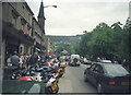
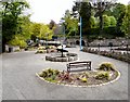
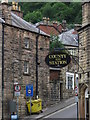
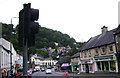
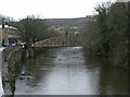
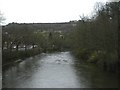
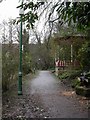
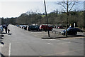


100 photos from this area
Area Information
Key information about the DE4 3NS including its size, population, and administrative classification.
- Area Type
- Postcode
- Area Size
- 9.7 hectares
- Population
- 1447
- Population Density
- 127 people/km²
House Prices in DE4 3NS
63
Properties
£281,250
Average Sold Price
£55,000
Lowest Price
£590,000
Highest Price
Showing 63 properties
| Address | Type | Beds | Baths | Last Sale Price | Last Sale Date | |
|---|---|---|---|---|---|---|
| The Hermitage, 86 North Parade, Matlock Bath, DE4 3NS | Semi-detached | 5 | 5 | £590,000 | Apr 2023 | |
| 92-94 North Parade, Matlock Bath, DE4 3NS | Semi-detached | 7 | 6 | £370,000 | May 2005 | |
| 28 North Parade, Matlock Bath, DE4 3NS | Flat | - | - | £55,000 | Jul 2002 | |
| 104 North Parade, Matlock Bath, DE4 3NS | Detached | - | - | £110,000 | Aug 1999 | |
| 46 North Parade, Matlock Bath, DE4 3NS | Restaurant | 7 | - | - | - | |
| 6 North Parade, Matlock Bath, DE4 3NS | Flat | 7 | - | - | - | |
| Flat 1, 42 North Parade, Matlock Bath, DE4 3NS | Flat | - | - | - | - | |
| 84 North Parade, Matlock Bath, DE4 3NS | Semi-detached | 8 | 7 | - | - | |
| Flat 2, 64-70 North Parade, Matlock Bath, DE4 3NS | Flat | 1 | 1 | - | - | |
| Flat Above, 136 North Parade, Matlock Bath, DE4 3NS | Flat | - | - | - | - |
Page 1 of 7
Energy Efficiency in DE4 3NS
Amenities
Schools
| Rank | School | Type | Entry gender | Ages |
|---|
Explore more schools in this area
Go to Schools tabDemographics
Household Size
Two person
most common
Accommodation Type
Houses
most common
Tenure
80
majority
Ethnic Group
White
most common
Religion
N/A
most common
Household Composition
N/A
most common
Age
47
median
Adults (30-64 years)
most common
Household Deprivation
N/A
with no deprivation
NS-SEC
43
in Lower managerial occupations
Explore more demographic insights in this area
Go to Demographics tabPlanning
Planning Constraints
- Flood RiskPremium
- Ramsar Wetland SitesPremium
- Area of Outstanding Natural BeautyPremium
- Protected Nature ReservePremium
- Protected WoodlandPremium