Area Overview for DE4 2EY
Photos of DE4 2EY

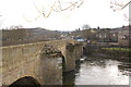

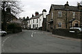

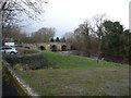


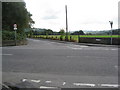


100 photos from this area
Area Information
Key information about the DE4 2EY including its size, population, and administrative classification.
- Area Type
- Postcode
- Area Size
- 7619 m²
- Population
- 1482
- Population Density
- 160 people/km²
House Prices in DE4 2EY
14
Properties
£179,250
Average Sold Price
£37,000
Lowest Price
£335,000
Highest Price
Showing 14 properties
| Address | Type | Beds | Baths | Last Sale Price | Last Sale Date | |
|---|---|---|---|---|---|---|
| Chesterfield House, Chesterfield Road, Two Dales, DE4 2EY | Semi-detached | 4 | 3 | £335,000 | Oct 2024 | |
| 6 Chesterfield Road, Two Dales, DE4 2EY | Semi-detached | 2 | 1 | £240,000 | Aug 2022 | |
| 3, Westmoreland Flats, Chesterfield Road, Two Dales, DE4 2EY | Flat | - | - | £94,000 | Apr 2021 | |
| Breakaway, Chesterfield Road, Two Dales, DE4 2EY | Detached | 3 | 1 | £228,000 | Dec 2020 | |
| 4, Westmoreland Flats, Chesterfield Road, Two Dales, DE4 2EY | Flat | - | - | £75,000 | Sep 2013 | |
| Winster Vista, Chesterfield Road, Two Dales, DE4 2EY | Semi-detached | - | - | £175,000 | Feb 2007 | |
| The Lodge, Chesterfield Road, Two Dales, DE4 2EY | Detached | - | - | £250,000 | Sep 2006 | |
| 1, Westmoreland Flats, Chesterfield Road, Two Dales, DE4 2EY | Maisonette | - | - | £37,000 | Mar 1995 | |
| House At, Two Dales Post Office, Chesterfield Road, Two Dales, DE4 2EY | Retail | - | - | - | - | |
| Oakdene, Chesterfield Road, Two Dales, DE4 2EY | Retail | 4 | 1 | - | - |
Page 1 of 2
Energy Efficiency in DE4 2EY
Amenities
Schools
| Rank | School | Type | Entry gender | Ages |
|---|
Explore more schools in this area
Go to Schools tabDemographics
Household Size
Two person
most common
Accommodation Type
Houses
most common
Tenure
86
majority
Ethnic Group
White
most common
Religion
N/A
most common
Household Composition
N/A
most common
Age
47
median
Adults (30-64 years)
most common
Household Deprivation
N/A
with no deprivation
NS-SEC
40
in Lower managerial occupations
Explore more demographic insights in this area
Go to Demographics tabPlanning
Planning Constraints
- Flood RiskPremium
- Ramsar Wetland SitesPremium
- Area of Outstanding Natural BeautyPremium
- Protected Nature ReservePremium
- Protected WoodlandPremium