Area Overview for DE24 9AQ
Photos of DE24 9AQ
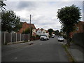
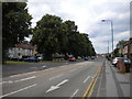
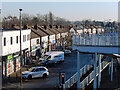
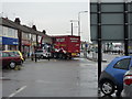
35 photos from this area
Area Information
Key information about the DE24 9AQ including its size, population, and administrative classification.
- Area Type
- Postcode
- Area Size
- 2.0 hectares
- Population
- 1791
- Population Density
- 6053 people/km²
House Prices in DE24 9AQ
44
Properties
£132,806
Average Sold Price
£21,000
Lowest Price
£310,000
Highest Price
Showing 44 properties
| Address | Type | Beds | Baths | Last Sale Price | Last Sale Date | |
|---|---|---|---|---|---|---|
| 63 Westgreen Avenue, Derby, DE24 9AQ | Bungalow | 2 | 1 | £150,000 | May 2025 | |
| 56 Westgreen Avenue, Derby, DE24 9AQ | house | - | - | £170,000 | Oct 2023 | |
| 65 Westgreen Avenue, Derby, DE24 9AQ | Semi-detached | 3 | - | £215,000 | Jul 2023 | |
| 61 Westgreen Avenue, Derby, DE24 9AQ | house | - | - | £200,000 | Aug 2022 | |
| 35A Westgreen Avenue, Derby, DE24 9AQ | Semi-detached | 3 | 1 | £155,000 | Sep 2020 | |
| 72 Westgreen Avenue, Derby, DE24 9AQ | house | - | - | £100,000 | Mar 2020 | |
| 53 Westgreen Avenue, Derby, DE24 9AQ | Semi-detached | 3 | 1 | £190,000 | Nov 2019 | |
| 62 Westgreen Avenue, Derby, DE24 9AQ | Detached | 3 | 1 | £136,500 | Oct 2018 | |
| 70 Westgreen Avenue, Derby, DE24 9AQ | house | - | - | £120,000 | Jul 2018 | |
| 59 Westgreen Avenue, Derby, DE24 9AQ | Detached | 3 | - | £194,950 | Nov 2015 |
Page 1 of 5
Energy Efficiency in DE24 9AQ
Amenities
Schools
| Rank | School | Type | Entry gender | Ages |
|---|
Explore more schools in this area
Go to Schools tabDemographics
Household Size
Family (3-5 people)
most common
Accommodation Type
Houses
most common
Tenure
50
majority
Ethnic Group
White
most common
Religion
N/A
most common
Household Composition
N/A
most common
Age
47
median
Adults (30-64 years)
most common
Household Deprivation
N/A
with no deprivation
NS-SEC
16
in Lower managerial occupations
Explore more demographic insights in this area
Go to Demographics tabPlanning
Planning Constraints
- Flood RiskPremium
- Ramsar Wetland SitesPremium
- Area of Outstanding Natural BeautyPremium
- Protected Nature ReservePremium
- Protected WoodlandPremium