Area Overview for DE24 8TG
Photos of DE24 8TG
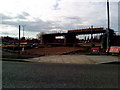
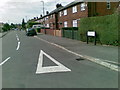
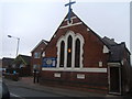
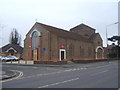
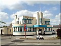
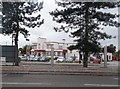
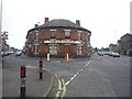
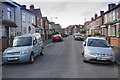
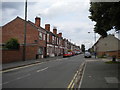
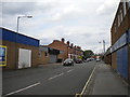
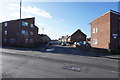
40 photos from this area
Area Information
Key information about the DE24 8TG including its size, population, and administrative classification.
- Area Type
- Postcode
- Area Size
- 8302 m²
- Population
- 1611
- Population Density
- 6005 people/km²
House Prices in DE24 8TG
32
Properties
£84,527
Average Sold Price
£12,000
Lowest Price
£195,000
Highest Price
Showing 32 properties
| Address | Type | Beds | Baths | Last Sale Price | Last Sale Date | |
|---|---|---|---|---|---|---|
| 309 Brighton Road, Derby, DE24 8TG | Semi-detached | 3 | 1 | £195,000 | Jul 2024 | |
| 315 Brighton Road, Derby, DE24 8TG | house | - | - | £151,000 | Sep 2023 | |
| 319 Brighton Road, Derby, DE24 8TG | Semi-detached | 3 | 1 | £170,000 | Jul 2023 | |
| 345 Brighton Road, Derby, DE24 8TG | house | - | - | £126,000 | Dec 2021 | |
| 387 Brighton Road, Derby, DE24 8TG | Terraced | 2 | 1 | £120,000 | Aug 2021 | |
| 333 Brighton Road, Derby, DE24 8TG | Semi-detached | 3 | 1 | £130,000 | Dec 2020 | |
| 367 Brighton Road, Derby, DE24 8TG | house | - | - | £53,550 | Sep 2020 | |
| 363 Brighton Road, Derby, DE24 8TG | Terraced | 2 | 1 | £100,000 | Feb 2020 | |
| 327 Brighton Road, Derby, DE24 8TG | house | - | - | £128,000 | Sep 2018 | |
| 389 Brighton Road, Derby, DE24 8TG | Terraced | 2 | 1 | £83,000 | Aug 2017 |
Page 1 of 4
Energy Efficiency in DE24 8TG
Amenities
Schools
| Rank | School | Type | Entry gender | Ages |
|---|
Explore more schools in this area
Go to Schools tabDemographics
Household Size
One person
most common
Accommodation Type
Houses
most common
Tenure
46
majority
Ethnic Group
White
most common
Religion
N/A
most common
Household Composition
N/A
most common
Age
47
median
Adults (30-64 years)
most common
Household Deprivation
N/A
with no deprivation
NS-SEC
18
in Lower managerial occupations
Explore more demographic insights in this area
Go to Demographics tabPlanning
Planning Constraints
- Flood RiskPremium
- Ramsar Wetland SitesPremium
- Area of Outstanding Natural BeautyPremium
- Protected Nature ReservePremium
- Protected WoodlandPremium