Area Overview for DE23 8PL
Photos of DE23 8PL
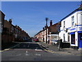
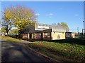
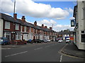
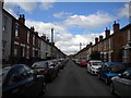
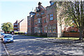
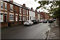
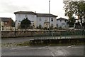
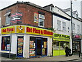
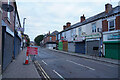
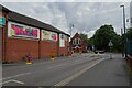
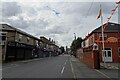
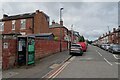
43 photos from this area
Area Information
Key information about the DE23 8PL including its size, population, and administrative classification.
- Area Type
- Postcode
- Area Size
- 7850 m²
- Population
- 2364
- Population Density
- 17472 people/km²
House Prices in DE23 8PL
25
Properties
£78,151
Average Sold Price
£27,000
Lowest Price
£190,000
Highest Price
Showing 25 properties
| Address | Type | Beds | Baths | Last Sale Price | Last Sale Date | |
|---|---|---|---|---|---|---|
| 164 Pear Tree Street, Derby, DE23 8PL | Terraced | 3 | 1 | £130,000 | Jun 2024 | |
| 162 Pear Tree Street, Derby, DE23 8PL | Terraced | 2 | - | £125,000 | Dec 2023 | |
| 135 Pear Tree Street, Derby, DE23 8PL | house | 5 | 1 | £190,000 | Oct 2021 | |
| 136 Pear Tree Street, Derby, DE23 8PL | Terraced | 4 | - | £106,000 | Feb 2015 | |
| 152 Pear Tree Street, Derby, DE23 8PL | house | - | - | £80,000 | Apr 2007 | |
| 146 Pear Tree Street, Derby, DE23 8PL | Terraced | - | - | £140,000 | Oct 2006 | |
| 115 Pear Tree Street, Derby, DE23 8PL | house | - | - | £48,410 | Dec 2005 | |
| 117 Pear Tree Street, Derby, DE23 8PL | house | - | - | £50,000 | Aug 2005 | |
| 168 Pear Tree Street, Derby, DE23 8PL | house | - | - | £63,000 | Oct 2004 | |
| 138 Pear Tree Street, Derby, DE23 8PL | house | - | - | £134,800 | Sep 2003 |
Page 1 of 3
Energy Efficiency in DE23 8PL
Amenities
Schools
| Rank | School | Type | Entry gender | Ages |
|---|
Explore more schools in this area
Go to Schools tabDemographics
Household Size
Family (3-5 people)
most common
Accommodation Type
Houses
most common
Tenure
38
majority
Ethnic Group
asian_total
most common
Religion
N/A
most common
Household Composition
N/A
most common
Age
22
median
Adults (30-64 years)
most common
Household Deprivation
N/A
with no deprivation
NS-SEC
9
in Lower managerial occupations
Explore more demographic insights in this area
Go to Demographics tabPlanning
Planning Constraints
- Flood RiskPremium
- Ramsar Wetland SitesPremium
- Area of Outstanding Natural BeautyPremium
- Protected Nature ReservePremium
- Protected WoodlandPremium