Area Overview for DE23 8HL
Photos of DE23 8HL
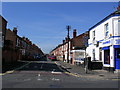
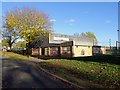
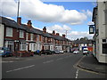
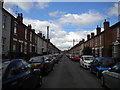
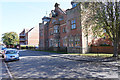
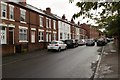
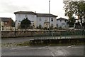
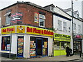
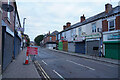
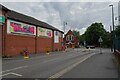
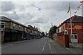
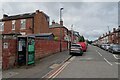
43 photos from this area
Area Information
Key information about the DE23 8HL including its size, population, and administrative classification.
- Area Type
- Postcode
- Area Size
- 6988 m²
- Population
- 2169
- Population Density
- 8821 people/km²
House Prices in DE23 8HL
30
Properties
£102,958
Average Sold Price
£23,000
Lowest Price
£170,000
Highest Price
Showing 30 properties
| Address | Type | Beds | Baths | Last Sale Price | Last Sale Date | |
|---|---|---|---|---|---|---|
| 50 Dairy House Road, Derby, DE23 8HL | house | - | - | £170,000 | Jul 2023 | |
| 10 Dairy House Road, Derby, DE23 8HL | house | - | - | £69,950 | Jan 2023 | |
| 12 Dairy House Road, Derby, DE23 8HL | house | - | - | £165,000 | Sep 2021 | |
| 40 Dairy House Road, Derby, DE23 8HL | house | - | - | £120,000 | Sep 2019 | |
| 36 Dairy House Road, Derby, DE23 8HL | Terraced | 4 | 1 | £120,000 | Jul 2018 | |
| 56 Dairy House Road, Derby, DE23 8HL | house | - | - | £51,500 | May 2013 | |
| 60 Dairy House Road, Derby, DE23 8HL | house | 3 | - | £117,000 | Apr 2010 | |
| 62 Dairy House Road, Derby, DE23 8HL | Terraced | 3 | 2 | £115,000 | Dec 2009 | |
| 34 Dairy House Road, Derby, DE23 8HL | Terraced | - | - | £155,000 | Dec 2007 | |
| 66 Dairy House Road, Derby, DE23 8HL | house | - | - | £128,000 | Dec 2006 |
Page 1 of 3
Energy Efficiency in DE23 8HL
Amenities
Schools
| Rank | School | Type | Entry gender | Ages |
|---|
Explore more schools in this area
Go to Schools tabDemographics
Household Size
Family (3-5 people)
most common
Accommodation Type
Houses
most common
Tenure
46
majority
Ethnic Group
asian_total
most common
Religion
N/A
most common
Household Composition
N/A
most common
Age
22
median
Adults (30-64 years)
most common
Household Deprivation
N/A
with no deprivation
NS-SEC
12
in Lower managerial occupations
Explore more demographic insights in this area
Go to Demographics tabPlanning
Planning Constraints
- Flood RiskPremium
- Ramsar Wetland SitesPremium
- Area of Outstanding Natural BeautyPremium
- Protected Nature ReservePremium
- Protected WoodlandPremium