Area Overview for DE23 8HH
Photos of DE23 8HH
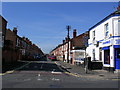
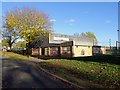
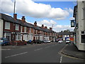
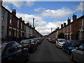
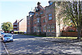
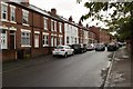
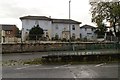
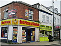
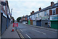
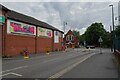
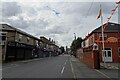
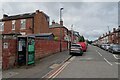
43 photos from this area
Area Information
Key information about the DE23 8HH including its size, population, and administrative classification.
- Area Type
- Postcode
- Area Size
- 4940 m²
- Population
- 2169
- Population Density
- 8821 people/km²
House Prices in DE23 8HH
24
Properties
£80,825
Average Sold Price
£18,200
Lowest Price
£168,000
Highest Price
Showing 24 properties
| Address | Type | Beds | Baths | Last Sale Price | Last Sale Date | |
|---|---|---|---|---|---|---|
| 97 Cambridge Street, Normanton, Derby, DE23 8HH | house | - | - | £168,000 | Apr 2025 | |
| 107 Cambridge Street, Normanton, Derby, DE23 8HH | Terraced | 4 | 1 | £90,000 | Feb 2018 | |
| 106 Cambridge Street, Normanton, Derby, DE23 8HH | Semi-detached | 3 | - | £93,750 | Mar 2014 | |
| 84 Cambridge Street, Normanton, Derby, DE23 8HH | Terraced | - | - | £95,000 | Nov 2007 | |
| 78 Cambridge Street, Normanton, Derby, DE23 8HH | house | - | - | £20,000 | Nov 1999 | |
| 109 Cambridge Street, Normanton, Derby, DE23 8HH | house | - | - | £18,200 | Apr 1995 | |
| 76 Cambridge Street, Normanton, Derby, DE23 8HH | Semi-detached | 3 | - | - | - | |
| 108-110 Cambridge Street, Normanton, Derby, DE23 8HH | Terraced | - | - | - | - | |
| 101 Cambridge Street, Normanton, Derby, DE23 8HH | house | - | - | - | - | |
| 82 Cambridge Street, Normanton, Derby, DE23 8HH | house | - | - | - | - |
Page 1 of 3
Energy Efficiency in DE23 8HH
Amenities
Schools
| Rank | School | Type | Entry gender | Ages |
|---|
Explore more schools in this area
Go to Schools tabDemographics
Household Size
Family (3-5 people)
most common
Accommodation Type
Houses
most common
Tenure
46
majority
Ethnic Group
asian_total
most common
Religion
N/A
most common
Household Composition
N/A
most common
Age
22
median
Adults (30-64 years)
most common
Household Deprivation
N/A
with no deprivation
NS-SEC
12
in Lower managerial occupations
Explore more demographic insights in this area
Go to Demographics tabPlanning
Planning Constraints
- Flood RiskPremium
- Ramsar Wetland SitesPremium
- Area of Outstanding Natural BeautyPremium
- Protected Nature ReservePremium
- Protected WoodlandPremium