Area Overview for DE23 8FD
Photos of DE23 8FD
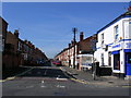
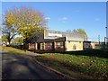
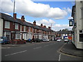
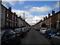
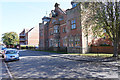
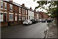
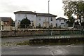
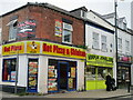
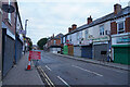
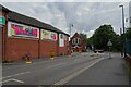
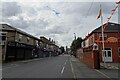
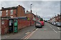
43 photos from this area
Area Information
Key information about the DE23 8FD including its size, population, and administrative classification.
- Area Type
- Postcode
- Area Size
- 6844 m²
- Population
- 2183
- Population Density
- 10970 people/km²
House Prices in DE23 8FD
20
Properties
£57,368
Average Sold Price
£12,000
Lowest Price
£117,000
Highest Price
Showing 20 properties
| Address | Type | Beds | Baths | Last Sale Price | Last Sale Date | |
|---|---|---|---|---|---|---|
| 50 Whitaker Street, Derby, DE23 8FD | Terraced | 2 | 2 | £117,000 | Nov 2024 | |
| 76 Whitaker Street, Derby, DE23 8FD | house | - | - | £95,000 | Dec 2022 | |
| 47 Whitaker Street, Derby, DE23 8FD | Terraced | 2 | - | £80,000 | Oct 2021 | |
| 46 Whitaker Street, Derby, DE23 8FD | house | - | - | £80,000 | Oct 2021 | |
| 72 Whitaker Street, Derby, DE23 8FD | house | 2 | - | £66,500 | Feb 2018 | |
| 75 Whitaker Street, Derby, DE23 8FD | Terraced | 3 | - | £90,000 | Mar 2017 | |
| 74 Whitaker Street, Derby, DE23 8FD | house | - | - | £85,000 | Nov 2006 | |
| 51 Whitaker Street, Derby, DE23 8FD | house | - | - | £62,000 | Jul 2005 | |
| 73 Whitaker Street, Derby, DE23 8FD | house | - | - | £47,950 | May 2003 | |
| 54 Whitaker Street, Derby, DE23 8FD | Terraced | - | - | £24,950 | Apr 2003 |
Page 1 of 2
Energy Efficiency in DE23 8FD
Amenities
Schools
| Rank | School | Type | Entry gender | Ages |
|---|
Explore more schools in this area
Go to Schools tabDemographics
Household Size
Family (3-5 people)
most common
Accommodation Type
Houses
most common
Tenure
34
majority
Ethnic Group
asian_total
most common
Religion
N/A
most common
Household Composition
N/A
most common
Age
47
median
Adults (30-64 years)
most common
Household Deprivation
N/A
with no deprivation
NS-SEC
11
in Lower managerial occupations
Explore more demographic insights in this area
Go to Demographics tabPlanning
Planning Constraints
- Flood RiskPremium
- Ramsar Wetland SitesPremium
- Area of Outstanding Natural BeautyPremium
- Protected Nature ReservePremium
- Protected WoodlandPremium