Area Overview for DE23 8BZ
Photos of DE23 8BZ
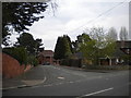
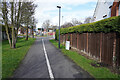
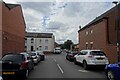
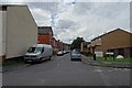
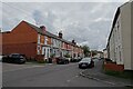
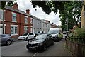
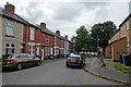
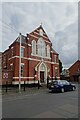
33 photos from this area
Area Information
Key information about the DE23 8BZ including its size, population, and administrative classification.
- Area Type
- Postcode
- Area Size
- 2325 m²
- Population
- 2639
- Population Density
- 9004 people/km²
House Prices in DE23 8BZ
15
Properties
£81,725
Average Sold Price
£25,250
Lowest Price
£125,000
Highest Price
Showing 15 properties
| Address | Type | Beds | Baths | Last Sale Price | Last Sale Date | |
|---|---|---|---|---|---|---|
| 10 St Augustine Street, Derby, DE23 8BZ | house | - | - | £125,000 | Jul 2022 | |
| 17 St Augustine Street, Derby, DE23 8BZ | house | 3 | - | £95,500 | Apr 2019 | |
| 12 St Augustine Street, Derby, DE23 8BZ | house | 3 | 1 | £71,000 | Jan 2014 | |
| 8 St Augustine Street, Derby, DE23 8BZ | house | - | - | £72,000 | Apr 2012 | |
| 13 St Augustine Street, Derby, DE23 8BZ | house | - | - | £84,500 | May 2010 | |
| 6 St Augustine Street, Derby, DE23 8BZ | house | 2 | 1 | £85,000 | Mar 2007 | |
| 11 St Augustine Street, Derby, DE23 8BZ | house | 2 | - | £92,000 | Jul 2006 | |
| 9 St Augustine Street, Derby, DE23 8BZ | house | - | - | £75,000 | Jul 2006 | |
| 14 St Augustine Street, Derby, DE23 8BZ | Terraced | - | - | £92,000 | Jun 2006 | |
| 16 St Augustine Street, Derby, DE23 8BZ | house | - | - | £25,250 | Feb 1997 |
Page 1 of 2
Energy Efficiency in DE23 8BZ
Amenities
Schools
| Rank | School | Type | Entry gender | Ages |
|---|
Explore more schools in this area
Go to Schools tabDemographics
Household Size
Family (3-5 people)
most common
Accommodation Type
Houses
most common
Tenure
40
majority
Ethnic Group
asian_total
most common
Religion
N/A
most common
Household Composition
N/A
most common
Age
22
median
Adults (30-64 years)
most common
Household Deprivation
N/A
with no deprivation
NS-SEC
11
in Lower managerial occupations
Explore more demographic insights in this area
Go to Demographics tabPlanning
Planning Constraints
- Flood RiskPremium
- Ramsar Wetland SitesPremium
- Area of Outstanding Natural BeautyPremium
- Protected Nature ReservePremium
- Protected WoodlandPremium