Area Overview for DE23 8BX
Photos of DE23 8BX
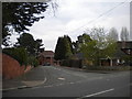
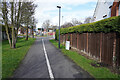
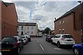
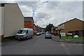
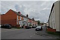
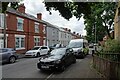
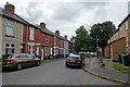
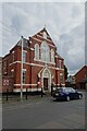
33 photos from this area
Area Information
Key information about the DE23 8BX including its size, population, and administrative classification.
- Area Type
- Postcode
- Area Size
- 1.3 hectares
- Population
- 2639
- Population Density
- 9004 people/km²
House Prices in DE23 8BX
37
Properties
£78,786
Average Sold Price
£22,000
Lowest Price
£200,000
Highest Price
Showing 37 properties
| Address | Type | Beds | Baths | Last Sale Price | Last Sale Date | |
|---|---|---|---|---|---|---|
| 19 Lewis Street, Derby, DE23 8BX | house | 3 | - | £200,000 | Mar 2025 | |
| 26 Lewis Street, Derby, DE23 8BX | Terraced | 2 | 1 | £146,000 | Jan 2025 | |
| 16 Lewis Street, Derby, DE23 8BX | house | - | - | £107,500 | Nov 2021 | |
| 32 Lewis Street, Derby, DE23 8BX | house | - | - | £110,000 | Sep 2021 | |
| 38 Lewis Street, Derby, DE23 8BX | house | 2 | - | £115,000 | Sep 2021 | |
| 14 Lewis Street, Derby, DE23 8BX | Terraced | 2 | 1 | £89,000 | Nov 2020 | |
| 30 Lewis Street, Derby, DE23 8BX | Terraced | 3 | 1 | £88,000 | Oct 2020 | |
| 48 Lewis Street, Derby, DE23 8BX | house | - | - | £90,000 | Jan 2017 | |
| 50 Lewis Street, Derby, DE23 8BX | house | - | - | £96,000 | Nov 2016 | |
| 34 Lewis Street, Derby, DE23 8BX | house | - | - | £80,000 | Oct 2015 |
Page 1 of 4
Energy Efficiency in DE23 8BX
Amenities
Schools
| Rank | School | Type | Entry gender | Ages |
|---|
Explore more schools in this area
Go to Schools tabDemographics
Household Size
Family (3-5 people)
most common
Accommodation Type
Houses
most common
Tenure
40
majority
Ethnic Group
asian_total
most common
Religion
N/A
most common
Household Composition
N/A
most common
Age
22
median
Adults (30-64 years)
most common
Household Deprivation
N/A
with no deprivation
NS-SEC
11
in Lower managerial occupations
Explore more demographic insights in this area
Go to Demographics tabPlanning
Planning Constraints
- Flood RiskPremium
- Ramsar Wetland SitesPremium
- Area of Outstanding Natural BeautyPremium
- Protected Nature ReservePremium
- Protected WoodlandPremium