Area Overview for DE23 8AD
Photos of DE23 8AD
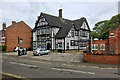
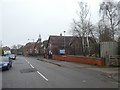
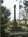
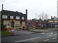
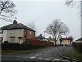
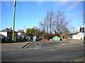
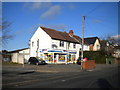
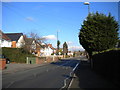
25 photos from this area
Area Information
Key information about the DE23 8AD including its size, population, and administrative classification.
- Area Type
- Postcode
- Area Size
- 8930 m²
- Population
- 2126
- Population Density
- 5847 people/km²
House Prices in DE23 8AD
30
Properties
£75,600
Average Sold Price
£15,300
Lowest Price
£180,000
Highest Price
Showing 30 properties
| Address | Type | Beds | Baths | Last Sale Price | Last Sale Date | |
|---|---|---|---|---|---|---|
| 81 Coleridge Street, Derby, DE23 8AD | Terraced | 3 | 1 | £180,000 | Sep 2024 | |
| 102 Coleridge Street, Derby, DE23 8AD | Flat | - | - | £70,000 | Jan 2022 | |
| 83 Coleridge Street, Derby, DE23 8AD | Semi-detached | 3 | 1 | £100,000 | Mar 2019 | |
| 124 Coleridge Street, Derby, DE23 8AD | Terraced | 3 | - | £105,000 | Oct 2017 | |
| 79 Coleridge Street, Derby, DE23 8AD | house | 3 | - | £60,500 | Nov 2011 | |
| 106 Coleridge Street, Derby, DE23 8AD | Flat | - | - | £42,000 | Mar 2010 | |
| 77 Coleridge Street, Derby, DE23 8AD | house | - | - | £15,300 | May 2002 | |
| 99 Coleridge Street, Derby, DE23 8AD | house | - | - | £32,000 | Jan 1999 | |
| 89 Coleridge Street, Derby, DE23 8AD | Flat | - | - | - | - | |
| 104 Coleridge Street, Derby, DE23 8AD | Maisonette | - | - | - | - |
Page 1 of 3
Energy Efficiency in DE23 8AD
Amenities
Schools
| Rank | School | Type | Entry gender | Ages |
|---|
Explore more schools in this area
Go to Schools tabDemographics
Household Size
Family (3-5 people)
most common
Accommodation Type
Houses
most common
Tenure
34
majority
Ethnic Group
White
most common
Religion
N/A
most common
Household Composition
N/A
most common
Age
47
median
Adults (30-64 years)
most common
Household Deprivation
N/A
with no deprivation
NS-SEC
15
in Lower managerial occupations
Explore more demographic insights in this area
Go to Demographics tabPlanning
Planning Constraints
- Flood RiskPremium
- Ramsar Wetland SitesPremium
- Area of Outstanding Natural BeautyPremium
- Protected Nature ReservePremium
- Protected WoodlandPremium