Area Overview for DE23 6TB
Photos of DE23 6TB
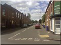
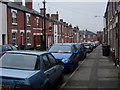
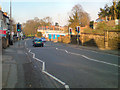
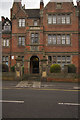
100 photos from this area
Area Information
Key information about the DE23 6TB including its size, population, and administrative classification.
- Area Type
- Postcode
- Area Size
- 1.7 hectares
- Population
- 2019
- Population Density
- 9546 people/km²
House Prices in DE23 6TB
64
Properties
£113,419
Average Sold Price
£19,250
Lowest Price
£229,999
Highest Price
Showing 64 properties
| Address | Type | Beds | Baths | Last Sale Price | Last Sale Date | |
|---|---|---|---|---|---|---|
| 38 Mount Carmel Street, Derby, DE23 6TB | Flat | - | - | £48,000 | Jul 2025 | |
| 46 Mount Carmel Street, Derby, DE23 6TB | Maisonette | 1 | 1 | £74,000 | May 2024 | |
| 54 Mount Carmel Street, Derby, DE23 6TB | Flat | - | - | £70,000 | Nov 2023 | |
| 31 Mount Carmel Street, Derby, DE23 6TB | Flat | 1 | 1 | £220,000 | Apr 2022 | |
| 34 Mount Carmel Street, Derby, DE23 6TB | house | - | - | £150,000 | Nov 2020 | |
| 17 Mount Carmel Street, Derby, DE23 6TB | Terraced | 5 | 5 | £186,500 | Oct 2020 | |
| 11 Mount Carmel Street, Derby, DE23 6TB | Terraced | 4 | - | £165,000 | Jun 2020 | |
| 21 Mount Carmel Street, Derby, DE23 6TB | Terraced | 1 | 1 | £195,000 | Aug 2019 | |
| 23 Mount Carmel Street, Derby, DE23 6TB | Terraced | 3 | 1 | £197,000 | Aug 2019 | |
| 42 Mount Carmel Street, Derby, DE23 6TB | Flat | 1 | 1 | £48,000 | May 2018 |
Page 1 of 7
Energy Efficiency in DE23 6TB
Amenities
Schools
| Rank | School | Type | Entry gender | Ages |
|---|
Explore more schools in this area
Go to Schools tabDemographics
Household Size
Family (3-5 people)
most common
Accommodation Type
Houses
most common
Tenure
55
majority
Ethnic Group
asian_total
most common
Religion
N/A
most common
Household Composition
N/A
most common
Age
47
median
Adults (30-64 years)
most common
Household Deprivation
N/A
with no deprivation
NS-SEC
19
in Lower managerial occupations
Explore more demographic insights in this area
Go to Demographics tabPlanning
Planning Constraints
- Flood RiskPremium
- Ramsar Wetland SitesPremium
- Area of Outstanding Natural BeautyPremium
- Protected Nature ReservePremium
- Protected WoodlandPremium