Area Overview for DE23 6AB
Photos of DE23 6AB
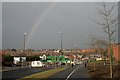
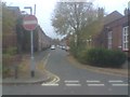
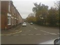
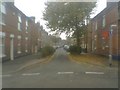
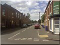
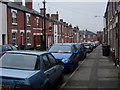
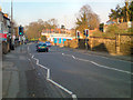
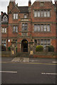
100 photos from this area
Area Information
Key information about the DE23 6AB including its size, population, and administrative classification.
- Area Type
- Postcode
- Area Size
- 7563 m²
- Population
- 2019
- Population Density
- 9546 people/km²
House Prices in DE23 6AB
13
Properties
£226,778
Average Sold Price
£72,000
Lowest Price
£460,000
Highest Price
Showing 13 properties
| Address | Type | Beds | Baths | Last Sale Price | Last Sale Date | |
|---|---|---|---|---|---|---|
| 159 Burton Road, Derby, DE23 6AB | Detached | 5 | 1 | £460,000 | Dec 2022 | |
| 193 Burton Road, Derby, DE23 6AB | house | 6 | - | £275,000 | Aug 2022 | |
| 147 Burton Road, Derby, DE23 6AB | house | 5 | 2 | £200,000 | Feb 2019 | |
| 157 Burton Road, Derby, DE23 6AB | Terraced | 5 | 1 | £250,000 | Jan 2018 | |
| 149 Burton Road, Derby, DE23 6AB | Terraced | 5 | 2 | £199,000 | Jul 2017 | |
| 155 Burton Road, Derby, DE23 6AB | Terraced | 5 | 3 | £230,000 | Jul 2007 | |
| The Gables Residential Care Home, 195 Burton Road, Derby, DE23 6AB | Retirement | - | - | £270,000 | May 2003 | |
| 151 Burton Road, Derby, DE23 6AB | house | - | - | £72,000 | Jun 2001 | |
| 153 Burton Road, Derby, DE23 6AB | Terraced | 6 | 1 | £85,000 | Mar 2000 | |
| Flat 4, 191 Burton Road, Derby, DE23 6AB | Flat | - | - | - | - |
Page 1 of 2
Energy Efficiency in DE23 6AB
Amenities
Schools
| Rank | School | Type | Entry gender | Ages |
|---|
Explore more schools in this area
Go to Schools tabDemographics
Household Size
Family (3-5 people)
most common
Accommodation Type
Houses
most common
Tenure
55
majority
Ethnic Group
asian_total
most common
Religion
N/A
most common
Household Composition
N/A
most common
Age
47
median
Adults (30-64 years)
most common
Household Deprivation
N/A
with no deprivation
NS-SEC
19
in Lower managerial occupations
Explore more demographic insights in this area
Go to Demographics tabPlanning
Planning Constraints
- Flood RiskPremium
- Ramsar Wetland SitesPremium
- Area of Outstanding Natural BeautyPremium
- Protected Nature ReservePremium
- Protected WoodlandPremium