Area Overview for DE23 6SA
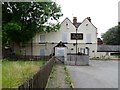
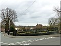
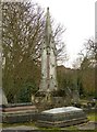
Photos of DE23 6SA

Area Information
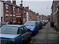
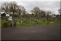
Living in DE23 6SA means being part of a tightly knit residential cluster in Derby, a city in the East Midlands. The area covers 3,505 square metres and is home to 2,019 people, creating a high population density of 576,018 people per square kilometre. This postcode is closely linked to Derby Arboretum, a historic park gifted to the city in 1840, which remains a focal point for recreation. The community here is predominantly adults aged 30–64, with a median age of 47, and the Asian_total ethnic group forms the largest demographic. Daily life is shaped by proximity to the Arboretum’s landscaped walkways, ponds, and playing fields, offering a blend of green space and urban living. The area’s small size means residents are likely to know their neighbours, and the nearby railway stations provide easy access to Derby’s city centre and beyond. While the population density is high, the presence of schools, retail outlets, and green spaces suggests a balance between urban convenience and community-oriented living.
- Area Type
- Postcode
- Area Size
- 3505 m²
- Population
- 2019
- Population Density
- 9546 people/km²
The property market in DE23 6SA is characterised by a 55% home ownership rate, indicating that nearly half of the properties are owner-occupied. The accommodation type is predominantly houses, which is unusual for a densely populated area. This suggests that the housing stock consists of family homes rather than apartments or flats, which may appeal to those seeking more space. The small size of the area means that the immediate surroundings likely share similar housing types, creating a cohesive architectural and residential environment. For buyers, this implies limited availability of properties, with competition likely among those seeking owner-occupied homes. The proximity to Derby’s transport networks and schools may enhance the area’s desirability, despite its compact size. However, the high population density could mean that properties are in close proximity to one another, which may be a consideration for those prioritising privacy or larger plots.
House Prices in DE23 6SA
Showing 1 properties
| Address | Type | Beds | Baths | Last Sale Price | Last Sale Date | |
|---|---|---|---|---|---|---|
| The Hawthorns Office, Temple House Clinic, Mill Hill Lane, Derby, DE23 6SA | Office | - | - | - | - |
Energy Efficiency in DE23 6SA
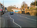
The lifestyle in DE23 6SA is shaped by its proximity to Derby Arboretum, a historic park offering walkways, ponds, and playing fields. This green space is a central feature for recreation, exercise, and relaxation. Nearby retail options include Lidl Normanton, Sainsburys Farm, and Aldi Normanton, providing convenience for daily shopping. The area’s railway stations—Derby, Peartree, and Spondon—connect residents to the city and beyond, enhancing accessibility. The compact nature of the postcode means that amenities are within practical reach, reducing the need for long commutes. The presence of schools, parks, and transport links creates a balanced environment, blending urban convenience with community-focused living. Residents benefit from a mix of retail, leisure, and transport options that support both daily needs and quality of life.
Amenities
Schools
Residents of DE23 6SA have access to a range of educational institutions, including nurseries, primary schools, and academies. Stonehill Nursery School and Derby St Chad’s CofE (VC) Nursery and Infant School cater to younger children, while St Joseph’s Catholic Primary School and St Joseph’s Catholic Voluntary Academy provide primary and secondary education. Derby St Chad’s CofE Nursery and Infant School holds an Ofsted rating of ‘good’, indicating a reliable standard of education. The mix of school types offers families choices between state and faith-based education. The presence of multiple schools within the area ensures that children can attend institutions close to home, reducing travel time. For families, this variety is a significant advantage, as it allows alignment with educational preferences, whether secular or faith-based. The academies, in particular, may offer specialist curricula or resources that appeal to specific needs.
| Rank | School | Type | Entry gender | Ages |
|---|
Explore more schools in this area
Go to Schools tabDemographics
DE23 6SA has a median age of 47, with the majority of residents falling within the 30–64 age range. This suggests a mature, stable community with a focus on family life and long-term residency. Home ownership is at 55%, indicating a mix of owner-occupied properties and rental units. The area is predominantly composed of houses, which is notable given the high population density. The predominant ethnic group is Asian_total, which influences the cultural fabric of the area. The population density of 576,018 per square kilometre is exceptionally high, reflecting a compact, densely populated environment. This density may impact the availability of private outdoor space but also fosters a sense of community. The data does not specify deprivation levels, but the high ownership rate and presence of amenities suggest a relatively stable economic profile. Residents here are likely to value proximity to green spaces, schools, and transport links, which are all within practical reach.
Household Size
Accommodation Type
Tenure
Ethnic Group
Religion
Household Composition
Age
Household Deprivation
NS-SEC
Explore more demographic insights in this area
Go to Demographics tabPlanning
Planning Constraints
- Flood RiskPremium
- Ramsar Wetland SitesPremium
- Area of Outstanding Natural BeautyPremium
- Protected Nature ReservePremium
- Protected WoodlandPremium