Area Overview for DE23 6NZ
Photos of DE23 6NZ
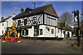
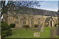
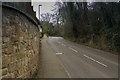
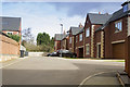
100 photos from this area
Area Information
Key information about the DE23 6NZ including its size, population, and administrative classification.
- Area Type
- Postcode
- Area Size
- 1.1 hectares
- Population
- 1812
- Population Density
- 4097 people/km²
House Prices in DE23 6NZ
12
Properties
£205,369
Average Sold Price
£79,950
Lowest Price
£375,000
Highest Price
Showing 12 properties
| Address | Type | Beds | Baths | Last Sale Price | Last Sale Date | |
|---|---|---|---|---|---|---|
| 35 Arlington Road, Derby, DE23 6NZ | house | - | - | £375,000 | Dec 2021 | |
| 39 Arlington Road, Derby, DE23 6NZ | Semi-detached | 5 | 2 | £230,000 | Oct 2019 | |
| 43 Arlington Road, Derby, DE23 6NZ | Semi-detached | 3 | 1 | £193,000 | Aug 2017 | |
| 47 Arlington Road, Derby, DE23 6NZ | Bungalow | 3 | 1 | £183,000 | Oct 2015 | |
| 37 Arlington Road, Derby, DE23 6NZ | Semi-detached | 4 | - | £218,000 | Dec 2014 | |
| 53 Arlington Road, Derby, DE23 6NZ | Detached | 3 | 1 | £240,000 | Nov 2003 | |
| 51 Arlington Road, Derby, DE23 6NZ | Bungalow | - | - | £124,000 | Jan 2000 | |
| 41 Arlington Road, Derby, DE23 6NZ | Semi-detached | - | - | £79,950 | May 1999 | |
| Mayfield, 45 Arlington Road, Derby, DE23 6NZ | Detached | - | - | - | - | |
| 34 Arlington Road, Derby, DE23 6NZ | Detached | - | - | - | - |
Page 1 of 2
Energy Efficiency in DE23 6NZ
Amenities
Schools
| Rank | School | Type | Entry gender | Ages |
|---|
Explore more schools in this area
Go to Schools tabDemographics
Household Size
Family (3-5 people)
most common
Accommodation Type
Houses
most common
Tenure
67
majority
Ethnic Group
asian_total
most common
Religion
N/A
most common
Household Composition
N/A
most common
Age
47
median
Adults (30-64 years)
most common
Household Deprivation
N/A
with no deprivation
NS-SEC
32
in Lower managerial occupations
Explore more demographic insights in this area
Go to Demographics tabPlanning
Planning Constraints
- Flood RiskPremium
- Ramsar Wetland SitesPremium
- Area of Outstanding Natural BeautyPremium
- Protected Nature ReservePremium
- Protected WoodlandPremium