Area Overview for DE23 6HA
Photos of DE23 6HA
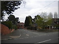
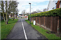
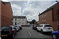
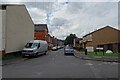
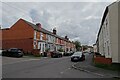
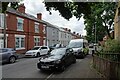
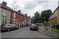
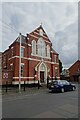
33 photos from this area
Area Information
Key information about the DE23 6HA including its size, population, and administrative classification.
- Area Type
- Postcode
- Area Size
- 7146 m²
- Population
- 2092
- Population Density
- 11616 people/km²
House Prices in DE23 6HA
18
Properties
£201,182
Average Sold Price
£77,000
Lowest Price
£355,000
Highest Price
Showing 18 properties
| Address | Type | Beds | Baths | Last Sale Price | Last Sale Date | |
|---|---|---|---|---|---|---|
| 44 Carlton Road, Derby, DE23 6HA | house | - | - | £355,000 | Feb 2023 | |
| 66 Carlton Road, Derby, DE23 6HA | Semi-detached | 4 | 2 | £285,000 | Jan 2022 | |
| 42 Carlton Road, Derby, DE23 6HA | Detached | 2 | 2 | £300,000 | Jul 2021 | |
| 60 Carlton Road, Derby, DE23 6HA | house | - | - | £230,000 | Sep 2020 | |
| 58 Carlton Road, Derby, DE23 6HA | house | - | - | £195,000 | Oct 2017 | |
| 52 Carlton Road, Derby, DE23 6HA | Semi-detached | 3 | 1 | £182,000 | Jan 2014 | |
| 26 Carlton Road, Derby, DE23 6HA | house | - | - | £155,000 | Dec 2009 | |
| 56 Carlton Road, Derby, DE23 6HA | Semi-detached | 3 | 1 | £189,000 | May 2005 | |
| 28 Carlton Road, Derby, DE23 6HA | house | - | - | £150,000 | Dec 2004 | |
| 30 Carlton Road, Derby, DE23 6HA | house | - | - | £95,000 | Jul 2004 |
Page 1 of 2
Energy Efficiency in DE23 6HA
Amenities
Schools
| Rank | School | Type | Entry gender | Ages |
|---|
Explore more schools in this area
Go to Schools tabDemographics
Household Size
Family (3-5 people)
most common
Accommodation Type
Houses
most common
Tenure
73
majority
Ethnic Group
asian_total
most common
Religion
N/A
most common
Household Composition
N/A
most common
Age
47
median
Adults (30-64 years)
most common
Household Deprivation
N/A
with no deprivation
NS-SEC
23
in Lower managerial occupations
Explore more demographic insights in this area
Go to Demographics tabPlanning
Planning Constraints
- Flood RiskPremium
- Ramsar Wetland SitesPremium
- Area of Outstanding Natural BeautyPremium
- Protected Nature ReservePremium
- Protected WoodlandPremium