Area Overview for DE22 4DS
Photos of DE22 4DS
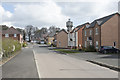
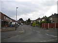
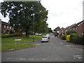
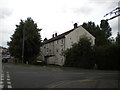
59 photos from this area
Area Information
Key information about the DE22 4DS including its size, population, and administrative classification.
- Area Type
- Postcode
- Area Size
- 2.2 hectares
- Population
- 1283
- Population Density
- 1351 people/km²
House Prices in DE22 4DS
49
Properties
£354,752
Average Sold Price
£155,000
Lowest Price
£4,636,340
Highest Price
Showing 49 properties
| Address | Type | Beds | Baths | Last Sale Price | Last Sale Date | |
|---|---|---|---|---|---|---|
| 19 Parsons Green, Derby, DE22 4DS | Terraced | 2 | 1 | £208,000 | Aug 2023 | |
| 8 Parsons Green, Derby, DE22 4DS | Detached | 3 | 2 | £280,000 | Aug 2023 | |
| 28 Parsons Green, Derby, DE22 4DS | house | - | - | £250,000 | Apr 2023 | |
| 23 Parsons Green, Derby, DE22 4DS | Terraced | 2 | 1 | £199,000 | Feb 2023 | |
| 25 Parsons Green, Derby, DE22 4DS | house | - | - | £241,500 | May 2022 | |
| 30 Parsons Green, Derby, DE22 4DS | house | - | - | £238,000 | Feb 2022 | |
| 14 Parsons Green, Derby, DE22 4DS | house | - | - | £235,000 | Nov 2021 | |
| 12 Parsons Green, Derby, DE22 4DS | house | 3 | 1 | £221,500 | Sep 2021 | |
| 35 Parsons Green, Derby, DE22 4DS | Semi-detached | 3 | 2 | £225,000 | Jul 2021 | |
| 3A Parsons Green, Derby, DE22 4DS | house | - | - | £338,000 | Mar 2021 |
Page 1 of 5
Energy Efficiency in DE22 4DS
Amenities
Schools
| Rank | School | Type | Entry gender | Ages |
|---|
Explore more schools in this area
Go to Schools tabDemographics
Household Size
Family (3-5 people)
most common
Accommodation Type
Houses
most common
Tenure
79
majority
Ethnic Group
White
most common
Religion
N/A
most common
Household Composition
N/A
most common
Age
47
median
Adults (30-64 years)
most common
Household Deprivation
N/A
with no deprivation
NS-SEC
51
in Lower managerial occupations
Explore more demographic insights in this area
Go to Demographics tabPlanning
Planning Constraints
- Flood RiskPremium
- Ramsar Wetland SitesPremium
- Area of Outstanding Natural BeautyPremium
- Protected Nature ReservePremium
- Protected WoodlandPremium