Area Overview for DE22 1HS
Photos of DE22 1HS
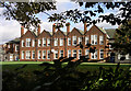
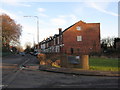
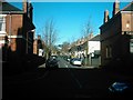
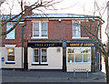
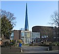
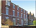
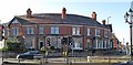
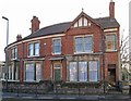
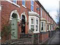
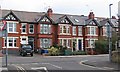
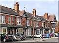
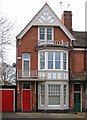
62 photos from this area
Area Information
Key information about the DE22 1HS including its size, population, and administrative classification.
- Area Type
- Postcode
- Area Size
- 2.2 hectares
- Population
- 1582
- Population Density
- 4991 people/km²
House Prices in DE22 1HS
69
Properties
£166,314
Average Sold Price
£60,000
Lowest Price
£339,950
Highest Price
Showing 69 properties
| Address | Type | Beds | Baths | Last Sale Price | Last Sale Date | |
|---|---|---|---|---|---|---|
| 20 Arthur Hind Close, Derby, DE22 1HS | Terraced | 3 | 1 | £220,000 | Nov 2023 | |
| 12 Arthur Hind Close, Derby, DE22 1HS | Terraced | 3 | - | £339,950 | Nov 2023 | |
| 34 Arthur Hind Close, Derby, DE22 1HS | Flat | 2 | 1 | £125,000 | Sep 2022 | |
| 21 Arthur Hind Close, Derby, DE22 1HS | Terraced | 3 | - | £158,000 | Oct 2020 | |
| 19 Arthur Hind Close, Derby, DE22 1HS | Terraced | 3 | 1 | £188,000 | May 2018 | |
| 6 Arthur Hind Close, Derby, DE22 1HS | Terraced | 3 | - | £160,000 | Jan 2017 | |
| 1 Arthur Hind Close, Derby, DE22 1HS | house | 3 | - | £146,000 | Jun 2008 | |
| 15 Arthur Hind Close, Derby, DE22 1HS | Terraced | 3 | 1 | £150,000 | Nov 2006 | |
| 16 Arthur Hind Close, Derby, DE22 1HS | Terraced | 3 | 1 | £147,500 | May 2006 | |
| 23 Arthur Hind Close, Derby, DE22 1HS | house | 3 | 1 | £135,000 | Jun 2005 |
Page 1 of 7
Energy Efficiency in DE22 1HS
Amenities
Schools
| Rank | School | Type | Entry gender | Ages |
|---|
Explore more schools in this area
Go to Schools tabDemographics
Household Size
One person
most common
Accommodation Type
Houses
most common
Tenure
63
majority
Ethnic Group
White
most common
Religion
N/A
most common
Household Composition
N/A
most common
Age
47
median
Adults (30-64 years)
most common
Household Deprivation
N/A
with no deprivation
NS-SEC
43
in Lower managerial occupations
Explore more demographic insights in this area
Go to Demographics tabPlanning
Planning Constraints
- Flood RiskPremium
- Ramsar Wetland SitesPremium
- Area of Outstanding Natural BeautyPremium
- Protected Nature ReservePremium
- Protected WoodlandPremium