Area Overview for DE22 1HD
Photos of DE22 1HD
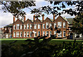
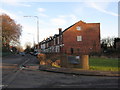
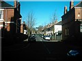
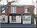
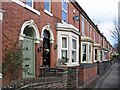
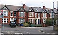
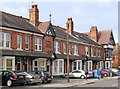
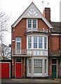
62 photos from this area
Area Information
Key information about the DE22 1HD including its size, population, and administrative classification.
- Area Type
- Postcode
- Area Size
- 7478 m²
- Population
- 1554
- Population Density
- 2884 people/km²
House Prices in DE22 1HD
22
Properties
£227,844
Average Sold Price
£44,500
Lowest Price
£430,000
Highest Price
Showing 22 properties
| Address | Type | Beds | Baths | Last Sale Price | Last Sale Date | |
|---|---|---|---|---|---|---|
| 10 Park Grove, Derby, DE22 1HD | house | 3 | 1 | £270,000 | Sep 2025 | |
| 6 Park Grove, Derby, DE22 1HD | Semi-detached | 3 | 1 | £265,000 | Jul 2025 | |
| 38 Park Grove, Derby, DE22 1HD | house | - | - | £350,000 | Jul 2022 | |
| 36 Park Grove, Derby, DE22 1HD | house | - | - | £270,000 | Jul 2022 | |
| 24 Park Grove, Derby, DE22 1HD | Semi-detached | 3 | 1 | £275,000 | Sep 2021 | |
| 18 Park Grove, Derby, DE22 1HD | Semi-detached | 3 | 1 | £237,500 | Jun 2021 | |
| 20 Park Grove, Derby, DE22 1HD | Semi-detached | 3 | 1 | £220,000 | Oct 2019 | |
| 22 Park Grove, Derby, DE22 1HD | Detached | 3 | 1 | £200,000 | Jul 2017 | |
| 12 Park Grove, Derby, DE22 1HD | house | - | - | £178,000 | Oct 2016 | |
| 2 Park Grove, Derby, DE22 1HD | house | - | - | £178,000 | Jan 2012 |
Page 1 of 3
Energy Efficiency in DE22 1HD
Amenities
Schools
| Rank | School | Type | Entry gender | Ages |
|---|
Explore more schools in this area
Go to Schools tabDemographics
Household Size
Two person
most common
Accommodation Type
Houses
most common
Tenure
87
majority
Ethnic Group
White
most common
Religion
N/A
most common
Household Composition
N/A
most common
Age
47
median
Adults (30-64 years)
most common
Household Deprivation
N/A
with no deprivation
NS-SEC
56
in Lower managerial occupations
Explore more demographic insights in this area
Go to Demographics tabPlanning
Planning Constraints
- Flood RiskPremium
- Ramsar Wetland SitesPremium
- Area of Outstanding Natural BeautyPremium
- Protected Nature ReservePremium
- Protected WoodlandPremium