Area Overview for DE21 6UR
Photos of DE21 6UR
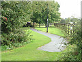
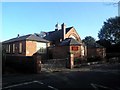
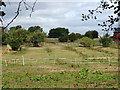
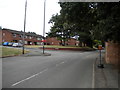
33 photos from this area
Area Information
Key information about the DE21 6UR including its size, population, and administrative classification.
- Area Type
- Postcode
- Area Size
- 3.5 hectares
- Population
- 1585
- Population Density
- 6257 people/km²
House Prices in DE21 6UR
70
Properties
£137,496
Average Sold Price
£36,000
Lowest Price
£225,000
Highest Price
Showing 70 properties
| Address | Type | Beds | Baths | Last Sale Price | Last Sale Date | |
|---|---|---|---|---|---|---|
| 299 Oregon Way, Derby, DE21 6UR | Bungalow | 2 | 1 | £225,000 | Feb 2025 | |
| 301 Oregon Way, Derby, DE21 6UR | Bungalow | - | - | £225,000 | Aug 2024 | |
| 263 Oregon Way, Derby, DE21 6UR | Bungalow | - | - | £198,000 | Oct 2023 | |
| 144 Oregon Way, Derby, DE21 6UR | house | 3 | - | £130,000 | Nov 2022 | |
| 305 Oregon Way, Derby, DE21 6UR | Semi-detached | 2 | 1 | £210,000 | Sep 2022 | |
| 295 Oregon Way, Derby, DE21 6UR | Bungalow | - | - | £192,500 | Aug 2021 | |
| 265 Oregon Way, Derby, DE21 6UR | Bungalow | 3 | - | £200,000 | Mar 2021 | |
| 293 Oregon Way, Derby, DE21 6UR | Bungalow | - | - | £175,000 | Jan 2021 | |
| 146 Oregon Way, Derby, DE21 6UR | house | - | - | £145,000 | Dec 2020 | |
| 279 Oregon Way, Derby, DE21 6UR | Detached | 3 | - | £215,000 | Sep 2020 |
Page 1 of 7
Energy Efficiency in DE21 6UR
Amenities
Schools
| Rank | School | Type | Entry gender | Ages |
|---|
Explore more schools in this area
Go to Schools tabDemographics
Household Size
Family (3-5 people)
most common
Accommodation Type
Houses
most common
Tenure
58
majority
Ethnic Group
White
most common
Religion
N/A
most common
Household Composition
N/A
most common
Age
47
median
Adults (30-64 years)
most common
Household Deprivation
N/A
with no deprivation
NS-SEC
20
in Lower managerial occupations
Explore more demographic insights in this area
Go to Demographics tabPlanning
Planning Constraints
- Flood RiskPremium
- Ramsar Wetland SitesPremium
- Area of Outstanding Natural BeautyPremium
- Protected Nature ReservePremium
- Protected WoodlandPremium