Area Overview for DE21 6GD
Photos of DE21 6GD
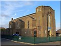
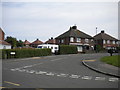
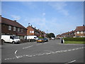
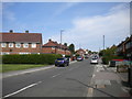
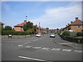
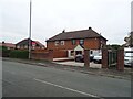
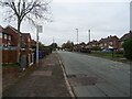
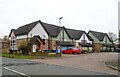
19 photos from this area
Area Information
Key information about the DE21 6GD including its size, population, and administrative classification.
- Area Type
- Postcode
- Area Size
- 9383 m²
- Population
- 1611
- Population Density
- 4828 people/km²
House Prices in DE21 6GD
25
Properties
£109,748
Average Sold Price
£73,230
Lowest Price
£160,000
Highest Price
Showing 25 properties
| Address | Type | Beds | Baths | Last Sale Price | Last Sale Date | |
|---|---|---|---|---|---|---|
| 56 Renfrew Street, Derby, DE21 6GD | house | 3 | 1 | £160,000 | Jun 2025 | |
| 54 Renfrew Street, Derby, DE21 6GD | Semi-detached | 3 | 1 | £160,000 | Dec 2024 | |
| 52 Renfrew Street, Derby, DE21 6GD | house | - | - | £107,000 | Oct 2023 | |
| 51 Renfrew Street, Derby, DE21 6GD | Semi-detached | 3 | 1 | £137,500 | Oct 2019 | |
| 49 Renfrew Street, Derby, DE21 6GD | Semi-detached | - | - | £73,230 | Aug 2016 | |
| 41 Renfrew Street, Derby, DE21 6GD | Terraced | 3 | 1 | £85,500 | Dec 2014 | |
| 60 Renfrew Street, Derby, DE21 6GD | house | 3 | 1 | £75,000 | Jan 2010 | |
| 50 Renfrew Street, Derby, DE21 6GD | Terraced | 3 | - | £109,000 | Jul 2007 | |
| 32 Renfrew Street, Derby, DE21 6GD | Terraced | - | - | £80,500 | Oct 2006 | |
| 34 Renfrew Street, Derby, DE21 6GD | Semi-detached | 3 | - | - | - |
Page 1 of 3
Energy Efficiency in DE21 6GD
Amenities
Schools
| Rank | School | Type | Entry gender | Ages |
|---|
Explore more schools in this area
Go to Schools tabDemographics
Household Size
Two person
most common
Accommodation Type
Houses
most common
Tenure
72
majority
Ethnic Group
White
most common
Religion
N/A
most common
Household Composition
N/A
most common
Age
47
median
Adults (30-64 years)
most common
Household Deprivation
N/A
with no deprivation
NS-SEC
24
in Lower managerial occupations
Explore more demographic insights in this area
Go to Demographics tabPlanning
Planning Constraints
- Flood RiskPremium
- Ramsar Wetland SitesPremium
- Area of Outstanding Natural BeautyPremium
- Protected Nature ReservePremium
- Protected WoodlandPremium