Area Overview for DE21 4HA
Photos of DE21 4HA

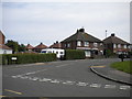
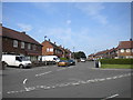
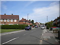
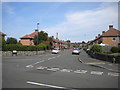
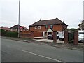
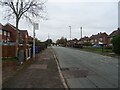
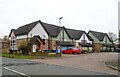
19 photos from this area
Area Information
Key information about the DE21 4HA including its size, population, and administrative classification.
- Area Type
- Postcode
- Area Size
- 1.9 hectares
- Population
- 1601
- Population Density
- 6021 people/km²
House Prices in DE21 4HA
52
Properties
£126,037
Average Sold Price
£30,950
Lowest Price
£251,000
Highest Price
Showing 52 properties
| Address | Type | Beds | Baths | Last Sale Price | Last Sale Date | |
|---|---|---|---|---|---|---|
| 96 Max Road, Derby, DE21 4HA | Semi-detached | 3 | 1 | £216,000 | Jun 2025 | |
| 88 Max Road, Derby, DE21 4HA | Semi-detached | 4 | 2 | £251,000 | Jan 2025 | |
| 94 Max Road, Derby, DE21 4HA | house | - | - | £245,000 | Jan 2023 | |
| 98 Max Road, Derby, DE21 4HA | house | - | - | £162,000 | Nov 2022 | |
| 102 Max Road, Derby, DE21 4HA | house | - | - | £190,000 | Feb 2022 | |
| 158 Max Road, Derby, DE21 4HA | house | - | - | £180,000 | Jul 2021 | |
| 110 Max Road, Derby, DE21 4HA | Semi-detached | 3 | - | £157,500 | Jun 2021 | |
| 150 Max Road, Derby, DE21 4HA | house | - | - | £131,000 | Oct 2019 | |
| 114 Max Road, Derby, DE21 4HA | house | - | - | £131,000 | Sep 2019 | |
| 130 Max Road, Derby, DE21 4HA | Semi-detached | 3 | 1 | £147,500 | Sep 2018 |
Page 1 of 6
Energy Efficiency in DE21 4HA
Amenities
Schools
| Rank | School | Type | Entry gender | Ages |
|---|
Explore more schools in this area
Go to Schools tabDemographics
Household Size
Family (3-5 people)
most common
Accommodation Type
Houses
most common
Tenure
72
majority
Ethnic Group
White
most common
Religion
N/A
most common
Household Composition
N/A
most common
Age
47
median
Adults (30-64 years)
most common
Household Deprivation
N/A
with no deprivation
NS-SEC
23
in Lower managerial occupations
Explore more demographic insights in this area
Go to Demographics tabPlanning
Planning Constraints
- Flood RiskPremium
- Ramsar Wetland SitesPremium
- Area of Outstanding Natural BeautyPremium
- Protected Nature ReservePremium
- Protected WoodlandPremium