Area Overview for DE21 4UB
Photos of DE21 4UB
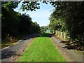
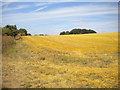
29 photos from this area
Area Information
Key information about the DE21 4UB including its size, population, and administrative classification.
- Area Type
- Postcode
- Area Size
- 3.1 hectares
- Population
- 1804
- Population Density
- 1557 people/km²
House Prices in DE21 4UB
47
Properties
£320,488
Average Sold Price
£187,950
Lowest Price
£520,000
Highest Price
Showing 47 properties
| Address | Type | Beds | Baths | Last Sale Price | Last Sale Date | |
|---|---|---|---|---|---|---|
| 25 Dale Acre Way, Derby, DE21 4UB | Detached | 4 | 2 | £402,000 | Oct 2025 | |
| 8 Dale Acre Way, Derby, DE21 4UB | Detached | 3 | 2 | £282,000 | May 2025 | |
| 38 Dale Acre Way, Derby, DE21 4UB | house | - | - | £249,999 | Apr 2025 | |
| 14 Dale Acre Way, Derby, DE21 4UB | Detached | 3 | 2 | £342,000 | Mar 2025 | |
| 16 Dale Acre Way, Derby, DE21 4UB | house | - | - | £353,000 | Feb 2025 | |
| 48 Dale Acre Way, Derby, DE21 4UB | Detached | 4 | 1 | £520,000 | Dec 2024 | |
| 21 Dale Acre Way, Derby, DE21 4UB | Detached | 4 | 2 | £375,000 | Apr 2024 | |
| 46 Dale Acre Way, Derby, DE21 4UB | house | - | - | £450,000 | Dec 2022 | |
| 9 Dale Acre Way, Derby, DE21 4UB | house | - | - | £428,950 | Oct 2022 | |
| 7 Dale Acre Way, Derby, DE21 4UB | house | - | - | £388,950 | Sep 2022 |
Page 1 of 5
Energy Efficiency in DE21 4UB
Amenities
Schools
| Rank | School | Type | Entry gender | Ages |
|---|
Explore more schools in this area
Go to Schools tabDemographics
Household Size
Two person
most common
Accommodation Type
Houses
most common
Tenure
61
majority
Ethnic Group
White
most common
Religion
N/A
most common
Household Composition
N/A
most common
Age
47
median
Adults (30-64 years)
most common
Household Deprivation
N/A
with no deprivation
NS-SEC
28
in Lower managerial occupations
Explore more demographic insights in this area
Go to Demographics tabPlanning
Planning Constraints
- Flood RiskPremium
- Ramsar Wetland SitesPremium
- Area of Outstanding Natural BeautyPremium
- Protected Nature ReservePremium
- Protected WoodlandPremium