Area Overview for DE21 4TZ
Photos of DE21 4TZ


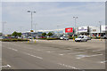


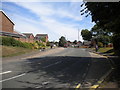


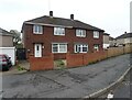
26 photos from this area
Area Information
Key information about the DE21 4TZ including its size, population, and administrative classification.
- Area Type
- Postcode
- Area Size
- 1.7 hectares
- Population
- 1804
- Population Density
- 1557 people/km²
House Prices in DE21 4TZ
19
Properties
£327,137
Average Sold Price
£219,950
Lowest Price
£415,000
Highest Price
Showing 19 properties
| Address | Type | Beds | Baths | Last Sale Price | Last Sale Date | |
|---|---|---|---|---|---|---|
| 12 Bandy Lane, Derby, DE21 4TZ | Detached | 4 | 2 | £415,000 | Dec 2025 | |
| 17 Bandy Lane, Derby, DE21 4TZ | Detached | 4 | 3 | £414,950 | May 2022 | |
| 15 Bandy Lane, Derby, DE21 4TZ | Detached | 4 | 3 | £372,950 | May 2022 | |
| 19 Bandy Lane, Derby, DE21 4TZ | house | - | - | £376,950 | May 2022 | |
| 13 Bandy Lane, Derby, DE21 4TZ | house | - | - | £378,950 | Apr 2022 | |
| 7 Bandy Lane, Derby, DE21 4TZ | house | - | - | £343,950 | Mar 2022 | |
| 9 Bandy Lane, Derby, DE21 4TZ | house | - | - | £275,950 | Feb 2022 | |
| 11 Bandy Lane, Derby, DE21 4TZ | house | - | - | £274,950 | Feb 2022 | |
| 16 Bandy Lane, Derby, DE21 4TZ | house | - | - | £364,950 | Dec 2021 | |
| 3 Bandy Lane, Derby, DE21 4TZ | house | - | - | £269,950 | Dec 2021 |
Page 1 of 2
Energy Efficiency in DE21 4TZ
Amenities
Schools
| Rank | School | Type | Entry gender | Ages |
|---|
Explore more schools in this area
Go to Schools tabDemographics
Household Size
Two person
most common
Accommodation Type
Houses
most common
Tenure
61
majority
Ethnic Group
White
most common
Religion
N/A
most common
Household Composition
N/A
most common
Age
47
median
Adults (30-64 years)
most common
Household Deprivation
N/A
with no deprivation
NS-SEC
28
in Lower managerial occupations
Explore more demographic insights in this area
Go to Demographics tabPlanning
Planning Constraints
- Flood RiskPremium
- Ramsar Wetland SitesPremium
- Area of Outstanding Natural BeautyPremium
- Protected Nature ReservePremium
- Protected WoodlandPremium