Area Overview for DE15 9SH
Photos of DE15 9SH
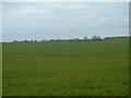
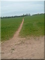
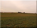
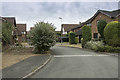
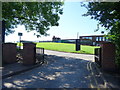
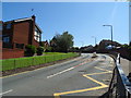
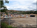
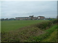
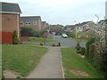
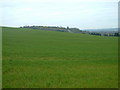
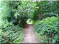
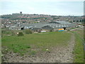
12 photos from this area
Area Information
Key information about the DE15 9SH including its size, population, and administrative classification.
- Area Type
- Postcode
- Area Size
- 4.2 hectares
- Population
- 1726
- Population Density
- 106 people/km²
House Prices in DE15 9SH
20
Properties
£137,800
Average Sold Price
£72,000
Lowest Price
£280,000
Highest Price
Showing 20 properties
| Address | Type | Beds | Baths | Last Sale Price | Last Sale Date | |
|---|---|---|---|---|---|---|
| 15 Bretlands Way, Stapenhill, Burton Upon Trent, DE15 9SH | house | - | - | £165,000 | Aug 2021 | |
| 6 Bretlands Way, Stapenhill, Burton Upon Trent, DE15 9SH | house | - | - | £280,000 | Jun 2019 | |
| 4 Bretlands Way, Stapenhill, Burton Upon Trent, DE15 9SH | Semi-detached | - | - | £99,000 | Jun 2015 | |
| 9 Bretlands Way, Stapenhill, Burton Upon Trent, DE15 9SH | Semi-detached | - | - | £120,000 | Jun 2009 | |
| 1 Bretlands Way, Stapenhill, Burton Upon Trent, DE15 9SH | Semi-detached | - | - | £150,000 | Nov 2007 | |
| 23 Bretlands Way, Stapenhill, Burton Upon Trent, DE15 9SH | Semi-detached | - | - | £149,000 | Jan 2007 | |
| 5 Bretlands Way, Stapenhill, Burton Upon Trent, DE15 9SH | Semi-detached | - | - | £135,000 | Jan 2006 | |
| 7 Bretlands Way, Stapenhill, Burton Upon Trent, DE15 9SH | Semi-detached | - | - | £90,000 | Jan 2004 | |
| 2 Bretlands Way, Stapenhill, Burton Upon Trent, DE15 9SH | house | - | - | £118,000 | Mar 2003 | |
| 17 Bretlands Way, Stapenhill, Burton Upon Trent, DE15 9SH | house | - | - | £72,000 | Apr 2002 |
Page 1 of 2
Energy Efficiency in DE15 9SH
Amenities
Schools
| Rank | School | Type | Entry gender | Ages |
|---|
Explore more schools in this area
Go to Schools tabDemographics
Household Size
Two person
most common
Accommodation Type
Houses
most common
Tenure
87
majority
Ethnic Group
White
most common
Religion
N/A
most common
Household Composition
N/A
most common
Age
47
median
Adults (30-64 years)
most common
Household Deprivation
N/A
with no deprivation
NS-SEC
47
in Lower managerial occupations
Explore more demographic insights in this area
Go to Demographics tabPlanning
Planning Constraints
- Flood RiskPremium
- Ramsar Wetland SitesPremium
- Area of Outstanding Natural BeautyPremium
- Protected Nature ReservePremium
- Protected WoodlandPremium